A month ago, Phase 1 of the Newberg-Dundee Bypass opened between OR-219 southeast of Newberg and OR-99W at the southern end of Dundee. As I mentioned in my bypass opening day photo tour, the planning took decades to get to the point where a new highway rolled along the countryside — and this is just the first phase of three. The good news is that the Oregon legislature funded the design of Phase 2 to the tune of $22 million [^], but it doesn’t look like it’ll start until 2020.
So while we wait, I figured I would write a blog post about the history of the bypass, from its predecessors to its current form and beyond. However, as usually happens, I started writing and researching a ton, and before long I had written a tome. Rather than drone on and on in one massive blog post, I decided to break the story up into multiple parts to maximize interest, create drama, and allow me to add more photos and diagrams than I would a much longer post.
Without further ado, let’s dive into the inaugural post by first looking at its parents, the McMinnville and Dayton Bypasses.
The story of the Newberg-Dundee Bypass began sixty years ago with a bypass in two neighboring cities, Dayton and McMinnville. Post-war coastal traffic was a boon for business but taxing on the highways in town. US-99W had already been moved onto a new alignment to the west of town by 1941, with the original route becoming the McMinnville Highway, Oregon State Highway #156, and there was talk of a “99W Alternate” that would start in McMinnville and eventually rejoin US-99 in Kelso, Washington1. It behooved state and local officials to keep cars moving and prevent gridlock and accidents, so they planned for a bypass to the south and east of the city as an eventual eastward extension of the Salmon River Highway #39 and its associated route, OR-18.
Dayton Bypass
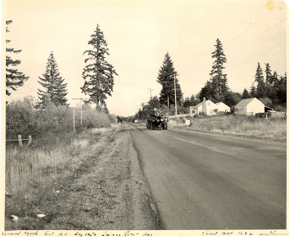
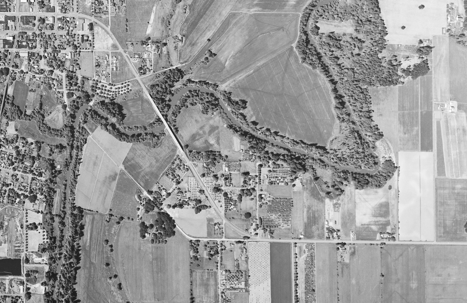
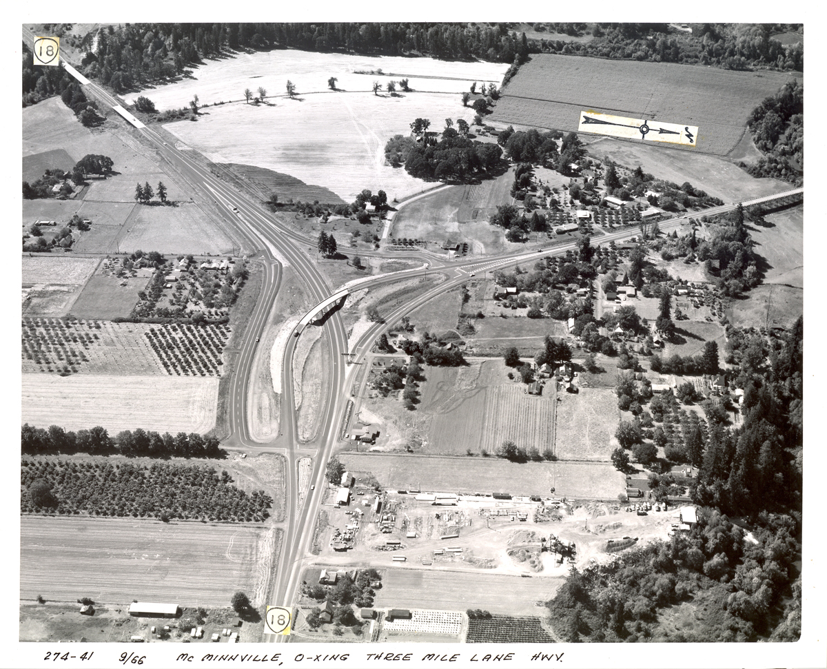
In 1957 the eastern portion, called the Dayton Bypass, began construction as a realignment of Three Mile Lane Highway #152 from the local airport to US-99W near Dayton. Completed as a two-lane road in 1959, it routed traffic to and from the coast, away from downtown McMinnville and small towns like Lafayette. It was partially grade-separated with a couple overpasses and a primitive interchange at Dayton. Right-of-way was reserved to the southeast of the bypass to allow for an eventual expansion to a four-lane freeway, but this has yet to happen 60 years later. One of the more obvious examples of this is the 8th Street/Fletcher Rd. overpass near Dayton. Also, Google Maps’ property outlines shows ROW was set aside for a future interchange at OR-233/Lafayette Highway.
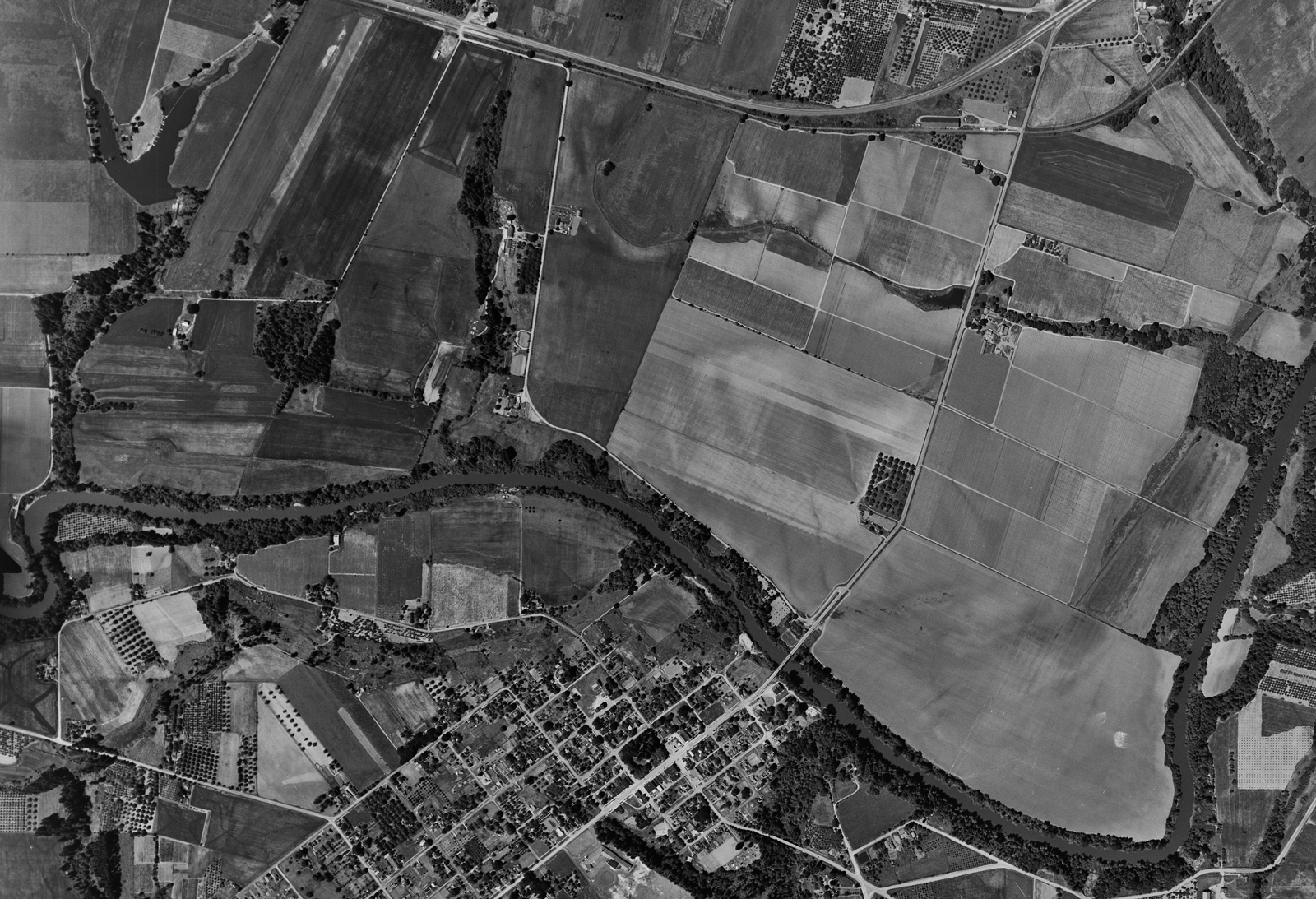
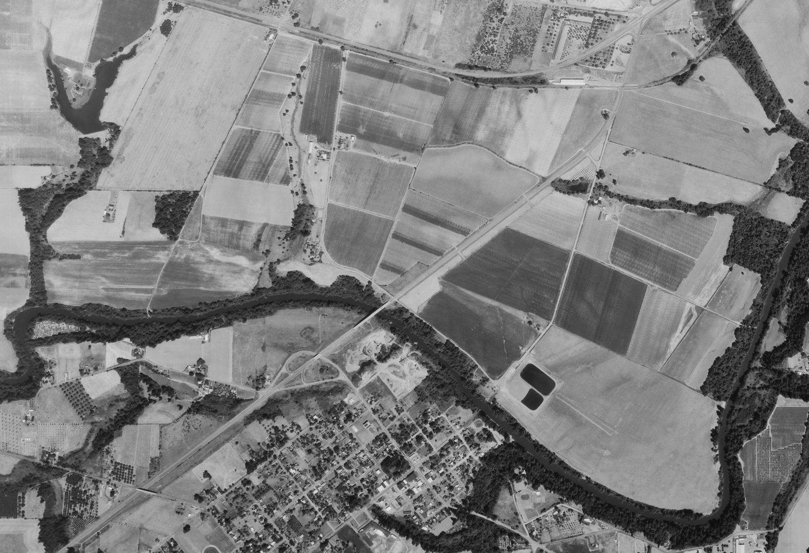
Like the original Three Mile Lane, most of the Dayton Bypass had no state route designation. At the time of the bypass’ construction, OR-221 and -233 were cosigned from US-99W at McDougall Corner to Dayton about a mile away; from there, OR-221 headed south to West Salem and OR-233 continued west to its junction with the Lafayette Hwy #154, heading south from there2. However, there was some confusion after its construction as to where the routes actually started, as Three Mile Lane’s August 1958 straightline chart shows OR-233 ending at the Dayton interchange with OR-221 continuing to meet US-99W. However, that chart has many errors on it, and I wouldn’t be surprised if that was one.

McMinnville Bypass
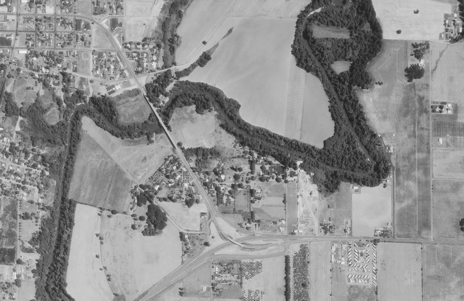
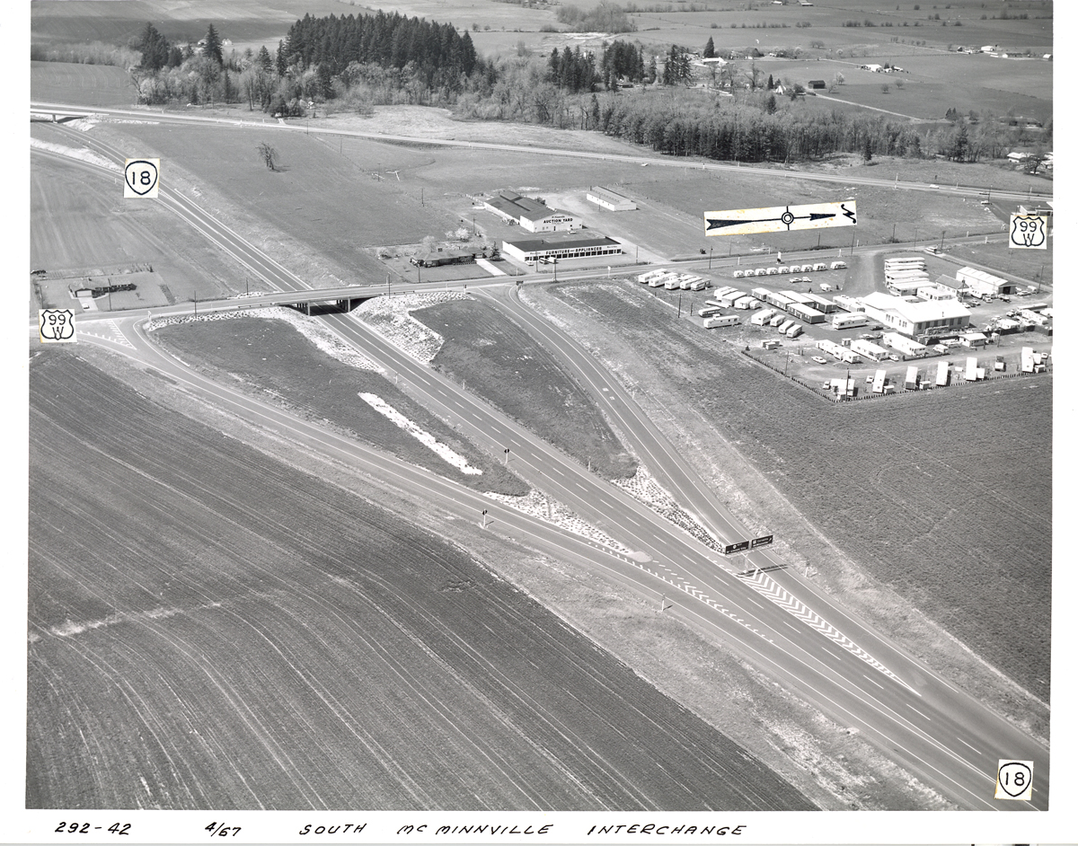
The western portion, called the McMinnville Bypass, was completed in 1964 between the airport and the eastern terminus of OR-18 due south of McMinnville. This realigned Three Mile Lane away from downtown McMinnville to the south of town. Like the Dayton Bypass, this section was built as a two-lane partial grade-separated road with overpasses and a couple of interchanges. Unlike the Dayton Bypass, however, the roadway design does not appear to set aside ROW for a future freeway conversion. If this were to happen, interchanges and bridges would need to be rebuilt or heavily modified.
“Which Way to the Beach?”
Upon completion, both bypasses were signed as OR-18, appearing to eliminate the earlier OR-233 designation in the June 1964 straightline chart. (However, OR-233 was later added back to that section alongside 18 by 1980.) Later, on March 14th 1967, the highway commission voted to extend the Salmon River Highway #39 over the entire bypass, eliminating the Three Mile Highway #152 designation entirely. The portion of Three Mile Lane that ran over the Yamhill River to McMinnville was retained in the system as the “McMinnville Spur” of the Salmon River Highway. Today, a 0.59-mile portion survives as McMinnville Spur Highway #483, so designated around 2011.
Throughout the 1960s and ’70s coastal tourism began to increase. This was in part due to the 1967 passage of the Beach Bill, which made all of Oregon’s beaches public property, and the creation of several new state parks. Further inland, McMinnville and Yamhill County began to grow in their own right due to an emerging wine industry within its existing agricultural economy. Just like anytime more people move to or travel through a growing city, the roads began to swell with traffic, causing delays and accidents. ODOT needed to find solutions.
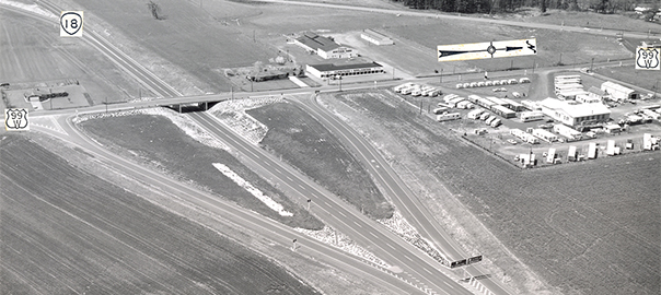
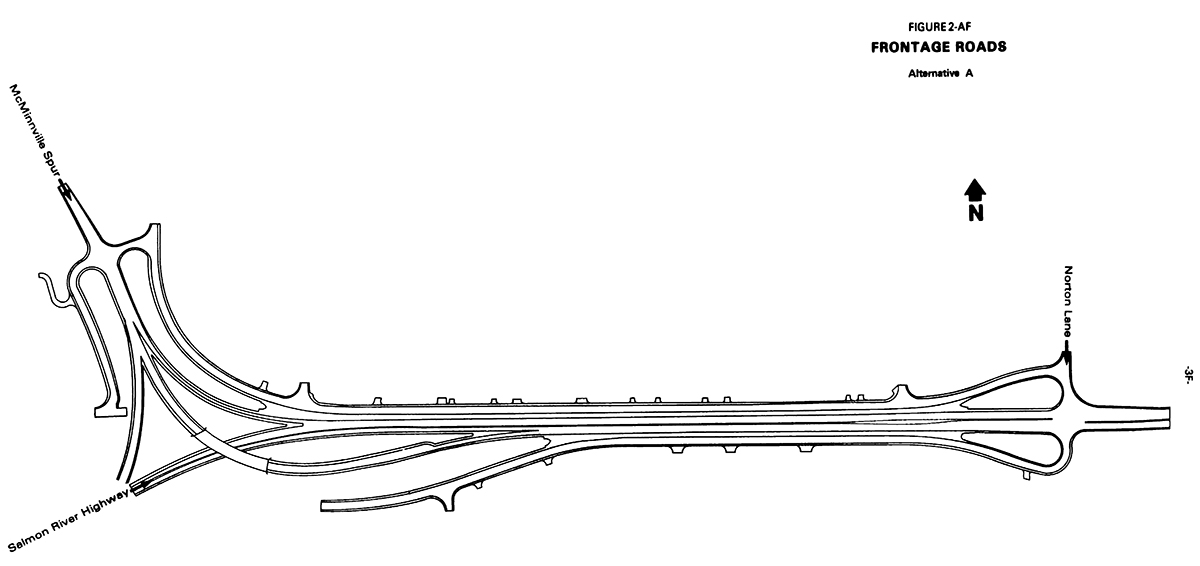
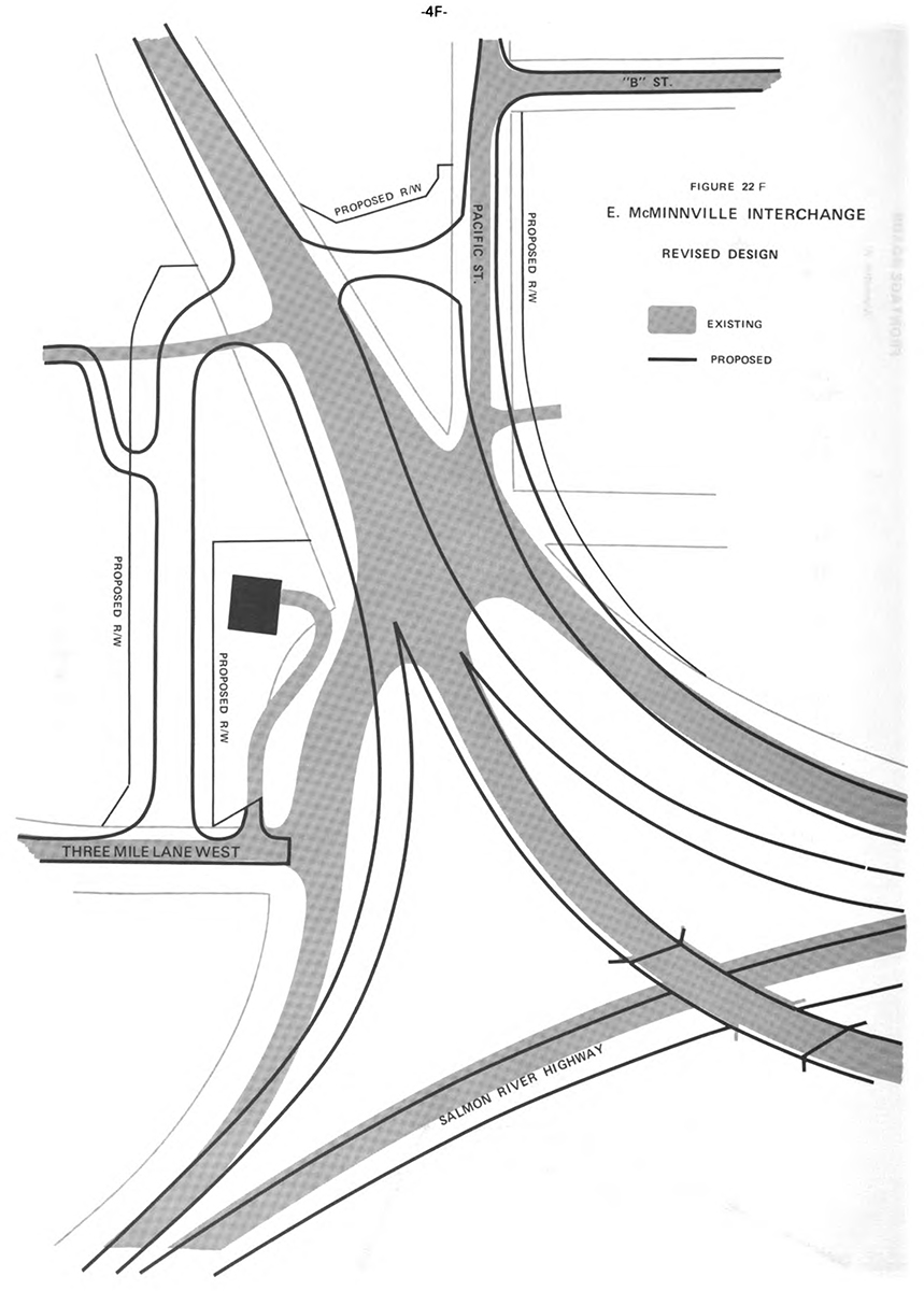
One such trouble spot along OR-18 was the East McMinnville interchange, the aforementioned junction with the McMinnville Spur/former Three Mile Lane near the airport. The interchange design was outdated, underpowered and dangerous, and OR-18 needed to be widened to properly accommodate merging and diverging traffic. To meet this need, ODOT designed an improvement to widen the highway to 4 lanes with a central turn lane and a revamped interchange to largely fix its issues. The Draft Environmental Impact Statement was released on April 27 1984 and the Final EIS was released March 11 1985, but the project wouldn’t be completed until sometime between 1990 and 1993.
Buried in the EIS’ Public Comments section were some questions asked by David Evers, an engineering technician at McMinnville Power and Light. His comments touched on a variety of subjects, but this one stands out:
Comment 30. A freeway to the coast bypassing Newberg, Dundee and McMinnville would lift the burden of running a major coastal highway through a growing populated area.3
ODOT dismissed state action on such a project at the time, but didn’t rule out the cities spearheading the initiative:
Response 30. Any request for a freeway to the coast bypassing Newberg, Dundee and McMinnville would have to be initiated through normal planning processes within Mr. Evers’ local government jurisdiction. At the present time such a project would not be justified from a traffic capacity standpoint and it is not included in the State’s Six Year Highway plan.4
In fact, Dundee’s Comprehensive Plan had supported a bypass around itself and Newberg since 19785, but the wheels would be set in motion by the end of the decade.
That’s all for now. Part 2 will be posted in the next day or so eventually. Until then, thanks for reading!
Footnotes
- “Portland Bypass Route Aired by State Planners”. The Oregonian, 1955 Jun 29, p. 28.
- Oregon State Highway Division,
Traffic Engineering Division. Description of US and ORE Numbered Highway Routes, 1958 Dec, pp. 23-24. - Federal Highway Administration and Oregon Department of Transportation. East McMinnville Interchange-Airport Road Final Environmental Impact Statement, 1985 Mar 11, p. 19F.
- ibid.
- Federal Highway Administration and Oregon Department of Transportation. Bypass Element Location (Tier 1) Draft Environmental Impact Statement, 2002 Sep 25, §4 p. 22.
I really appreciate your help with my project!
I worked with Dave Evers. Sounds like just the kind of question he would have asked!
Awesome! Glad to know I got that piece of information right. Thanks for stopping by!