Finally! After decades of planning and years of construction, I have posted to my highways blog!
Oh, and speaking of decades of planning, the Newberg-Dundee Bypass opened to auto and truck yesterday at the crack of 5 AM. To celebrate the momentous and rare occasion of the opening of a brand-new state highway, I took a drive down to Dundee to test out the new road — and take a ton of photos along the way. Rather than spam AARoads’ bypass thread with the 60+ photos I’ve curated (after taking more than 1200!) I figured I’d use this blog as intended — to report on highway developments in the state. Duh.
Before I dive into the photos and commentary, there are a couple things I took photos of that I won’t cover, and a couple things I didn’t manage to get photos of this time around. This entry won’t cover:
OR-18’s implied co-alignment with OR-99W: I photographed the portion south of the bypass along Pacific Highway West between Dundee and the OR-18 junction to see if there was any mention of OR-18 being cosigned with 99W. Nada. There weren’t even any route shields north or south along that stretch for either route. However, these will come in handy waaay down the line if/when Phase 3 is built. I also shot photos along OR-18 southwest of that junction to Dayton to see if OR-18 was mentioned as continuing onto the bypass. Zilch. It’s possible ODOT installed signage further back, but I’m not holding my breath.
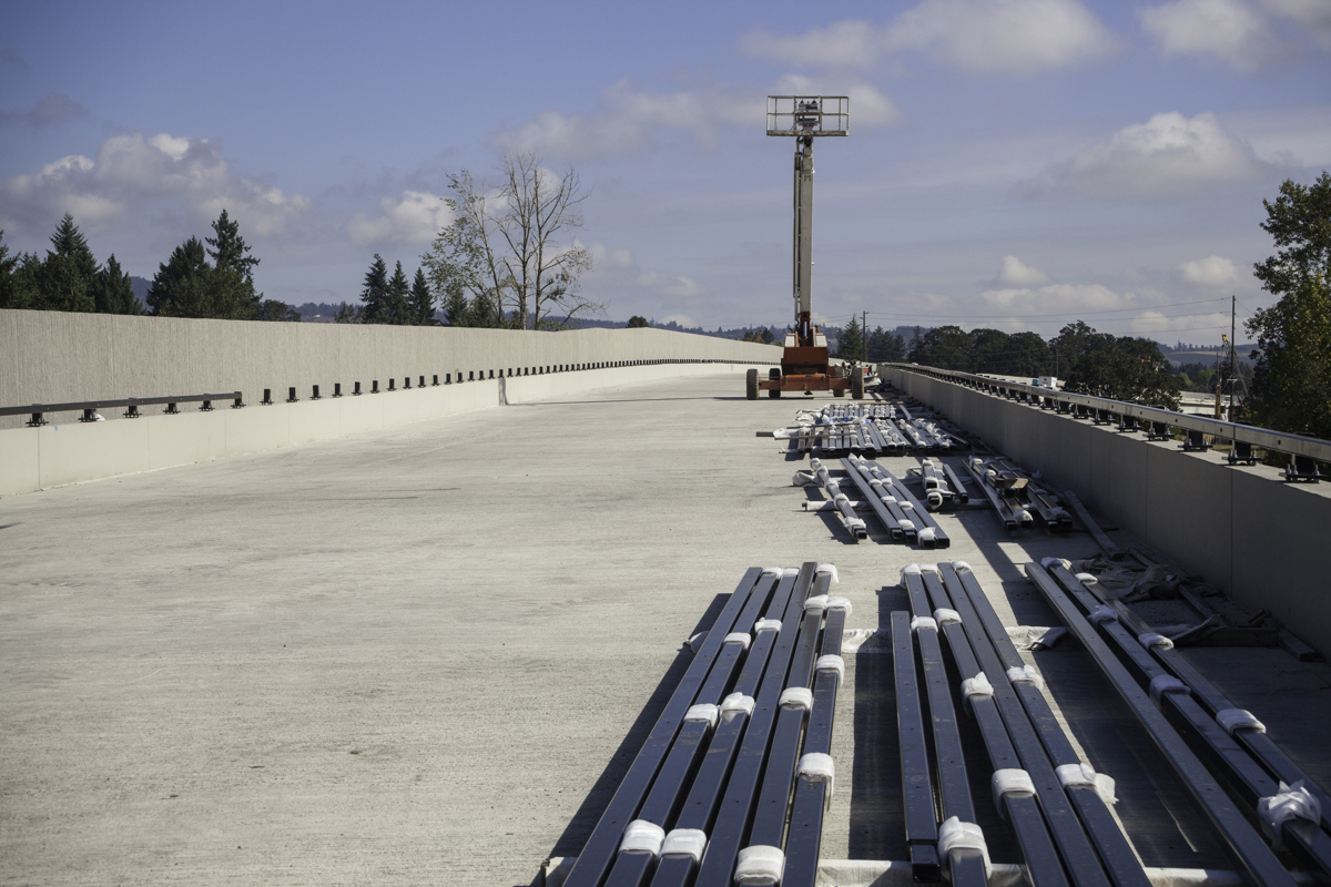
The viaduct from underneath: I took a bunch of shots on the viaduct, but not under it, for a couple reasons. I was starting to run out of daylight, and apparently almost ran out of room on my card. I’ll revisit this soon.
The Wynooski St. overpass: Same as the viaduct.
Newberg approach from OR-219 northbound: Ditto.
Newberg approach from OR-99W northbound: Excepting a new overhead sign just east of Springbrook Road (which will be covered), nothing really changed going this way, so I didn’t really shoot it. Priorities.
So without further ado, here’s my photographic field report on Newberg-Dundee Bypass, Day 1!
All photos were taken by me on January 5, 2018. Comparison photos were taken by me on September 2, 2017 (Newberg sign gantry) and September 23, 2017 (anything else).
Bypass Westbound
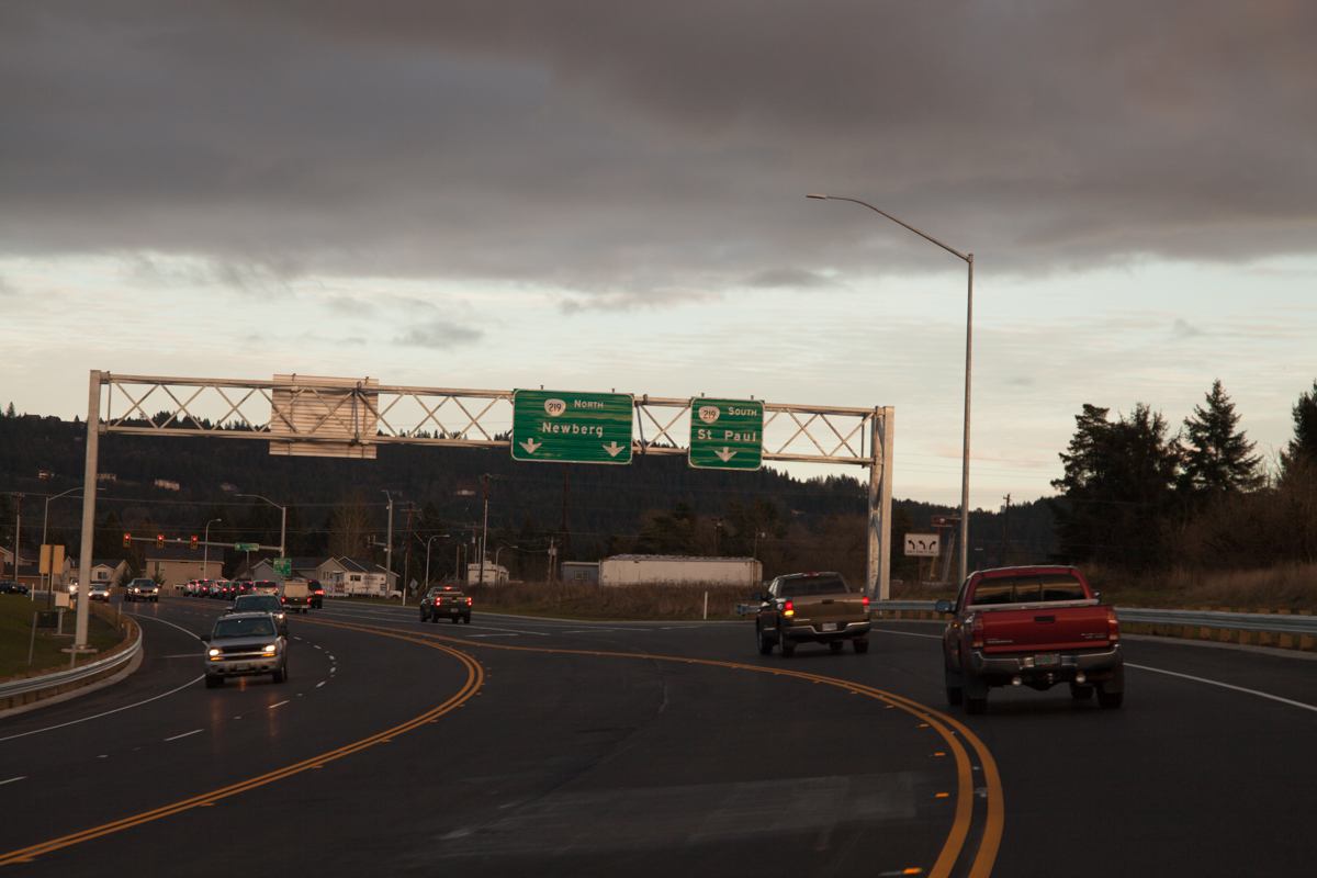
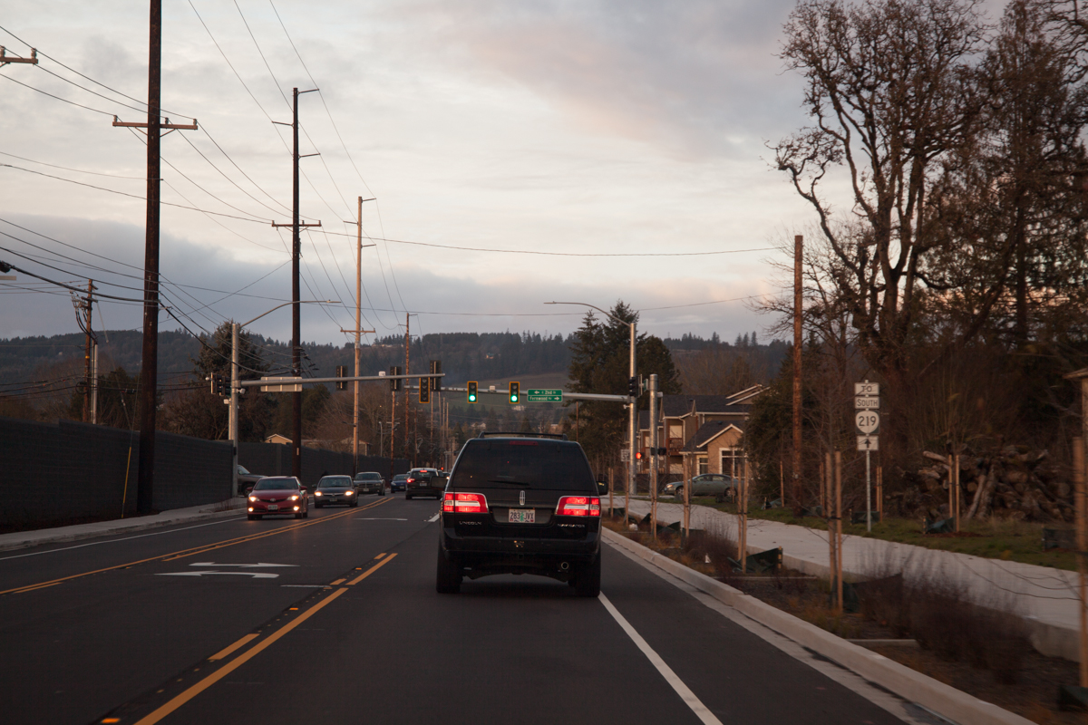
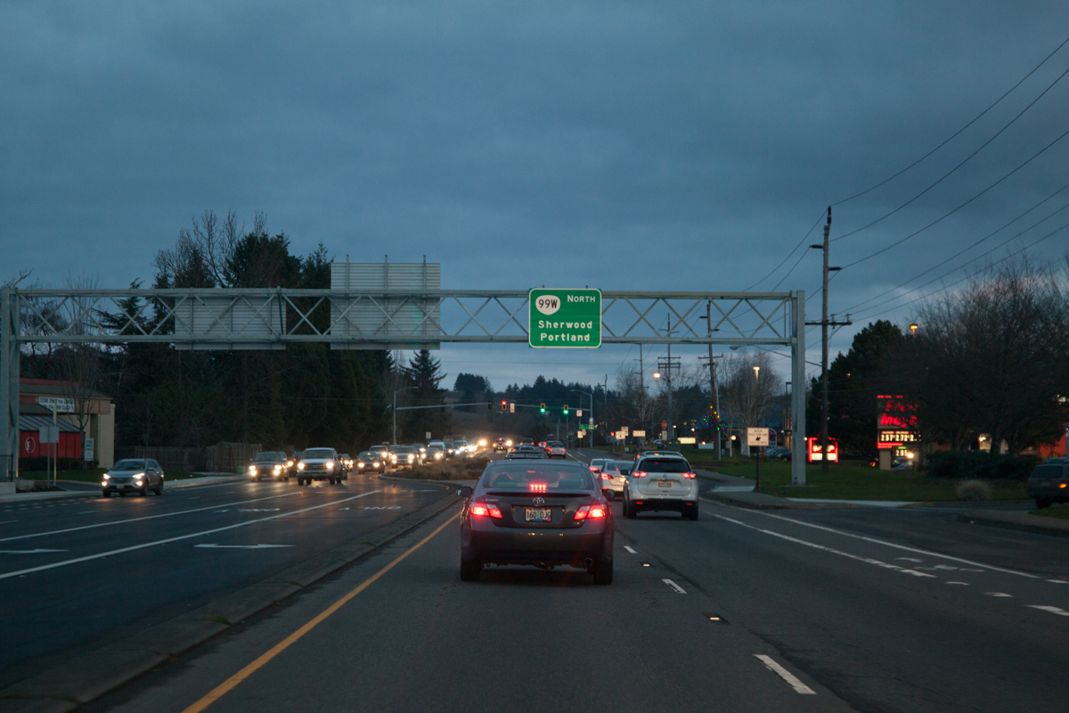
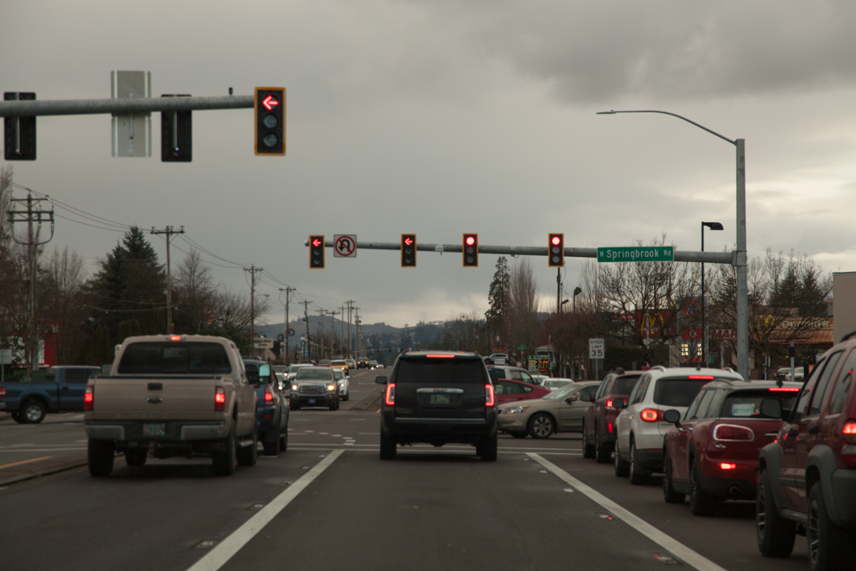
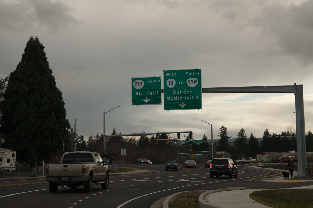
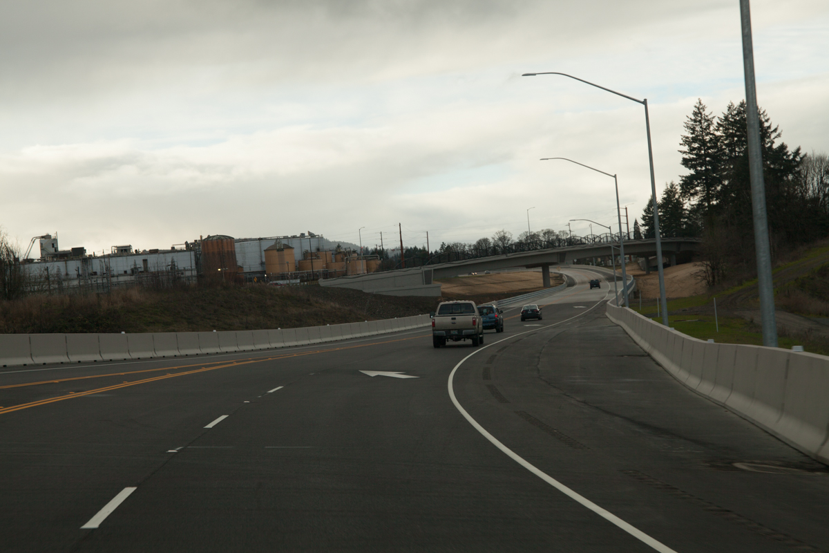
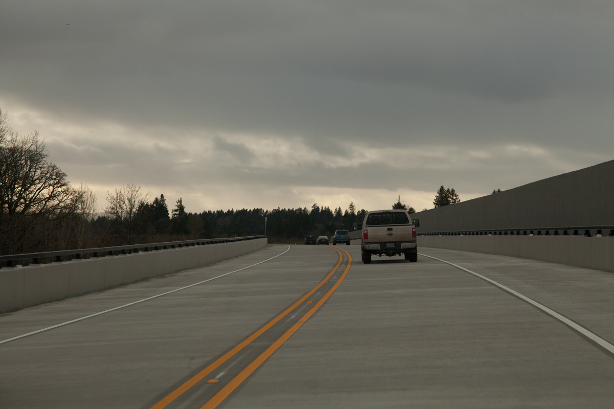
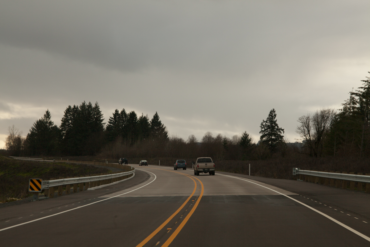
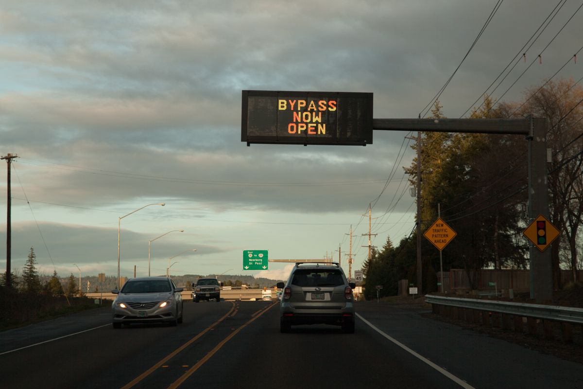
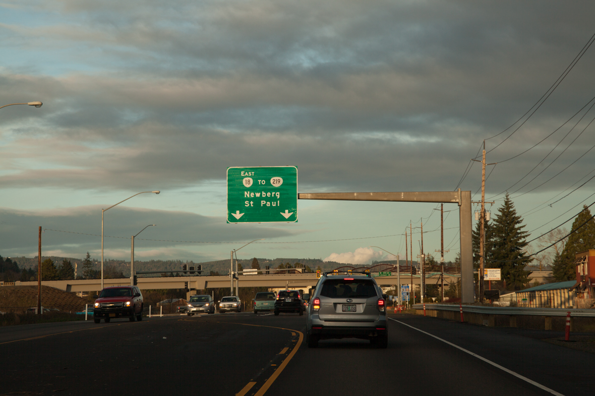
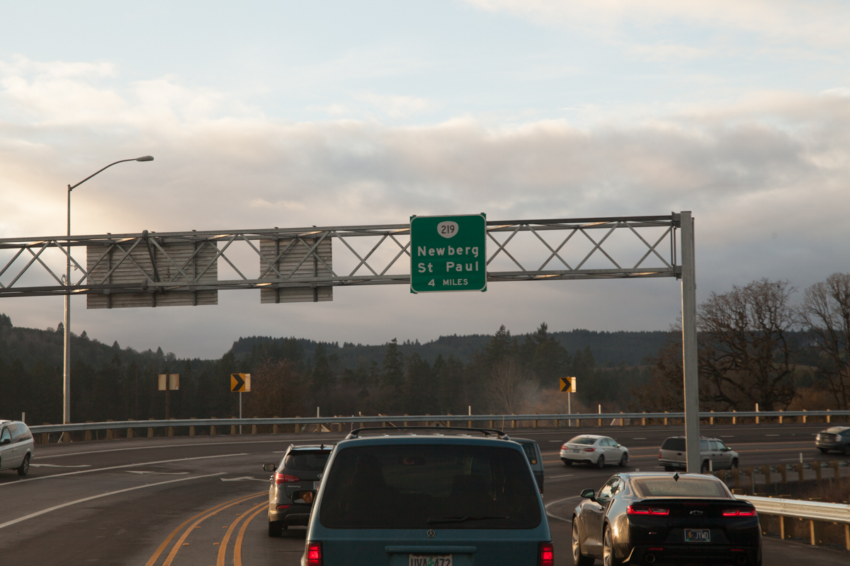
A VMS on OR-99W southbound just outside Newberg announcing the bypass’ opening.A new sign gantry over 99W just north of the Springbrook Rd. intersection, put up sometime in 2017. The sign implies that OR-18 follows Springbrook and a slight portion of OR-219 before turning onto the bypass. Also, 99W still goes through Dundee, but ODOT omits it from the 99W southbound sign to encourage use of the bypass. Compare to how it looked in September.Waiting to turn left on Springbrook.This sign shows where each left turn lane goes. From this perspective, however, it looks like the signs are pointing to the rightmost two lanes, not the leftmost. This sign also says “OR-18” instead of “TO OR-18″, further implicating OR-18 traverses these roads.In the turn lane for the bypass. ODOT has recently started putting the state route shield on its sign blades.Another overhead gantry on OR-219 south for the upcoming turn onto the bypass proper.Let’s do this thing.Yet another overhead gantry stating the distance until the end of the bypass, 4 miles. Also, the bypass features ODOT’s famous “SPEED” signs.Two lanes merge to one as we near the Wynooski St. overpass.
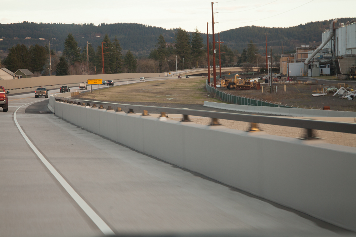
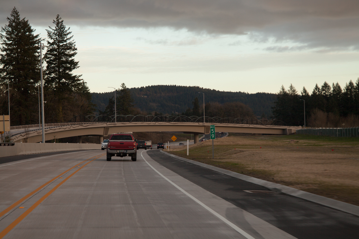
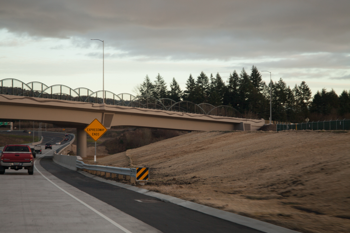
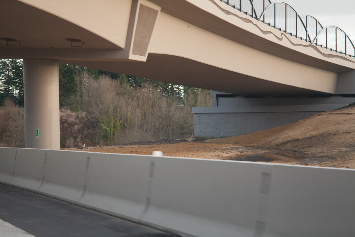
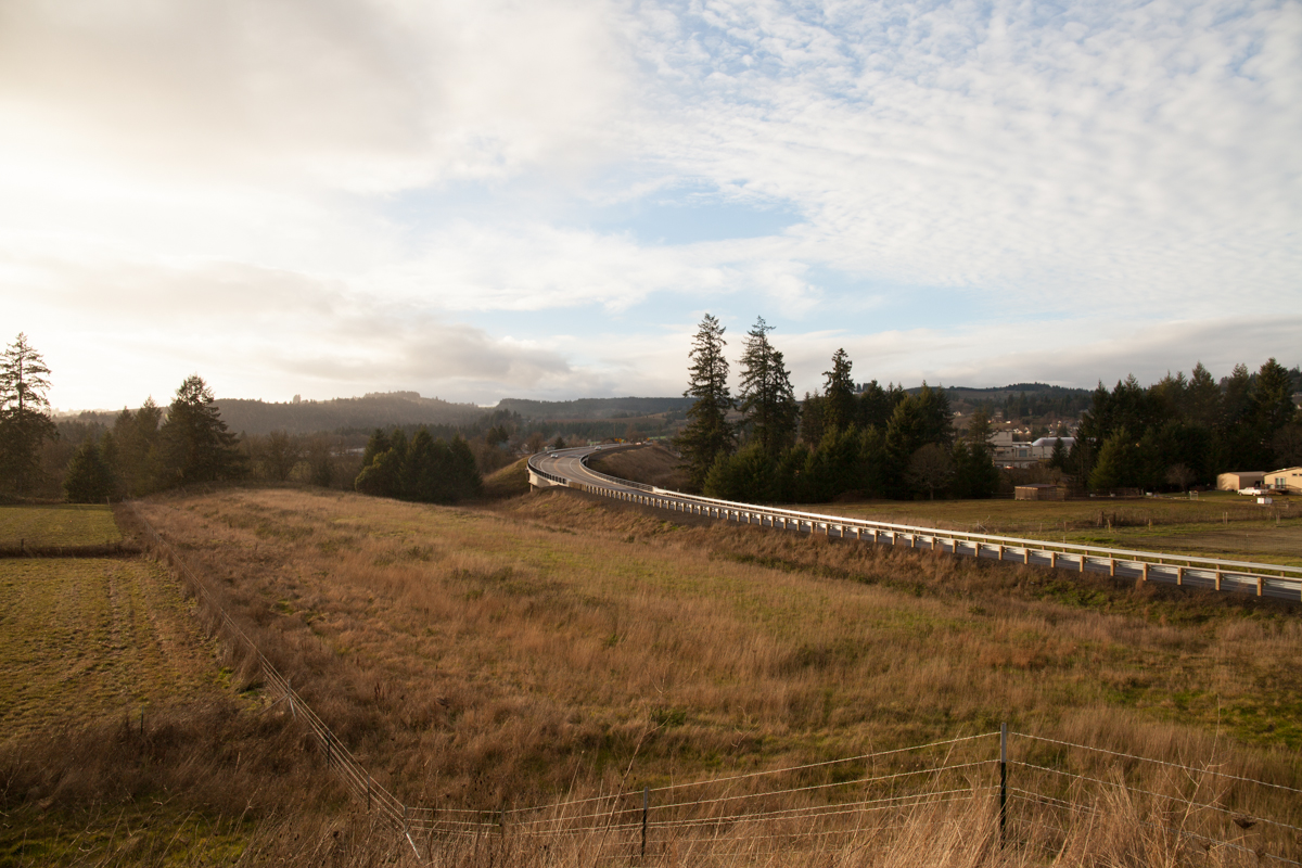
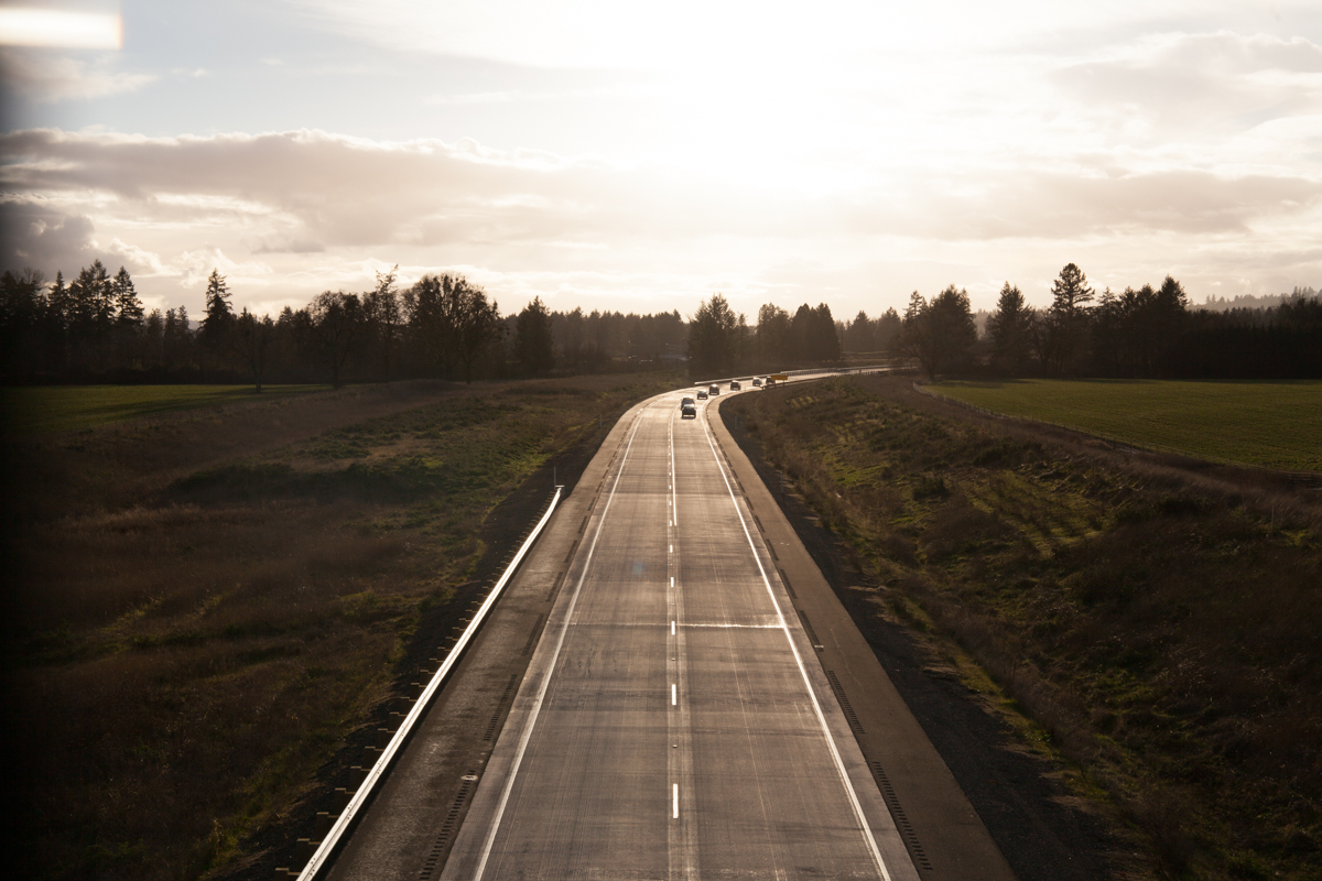
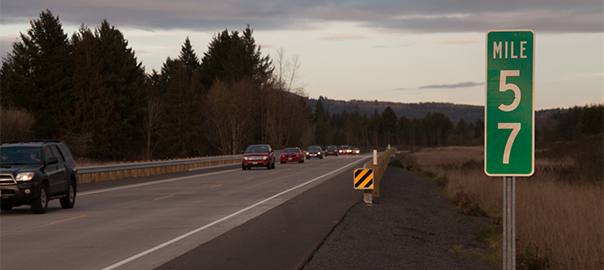
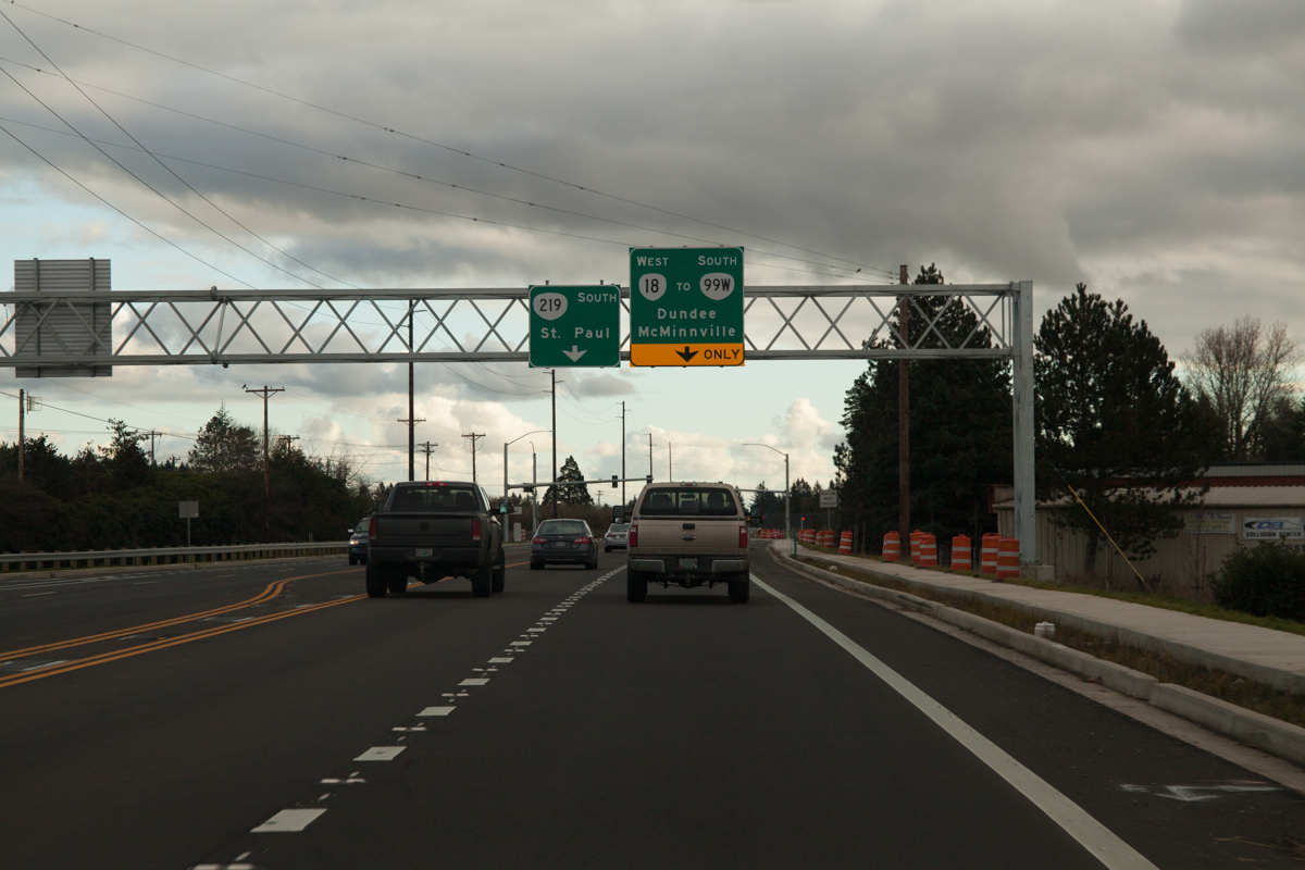
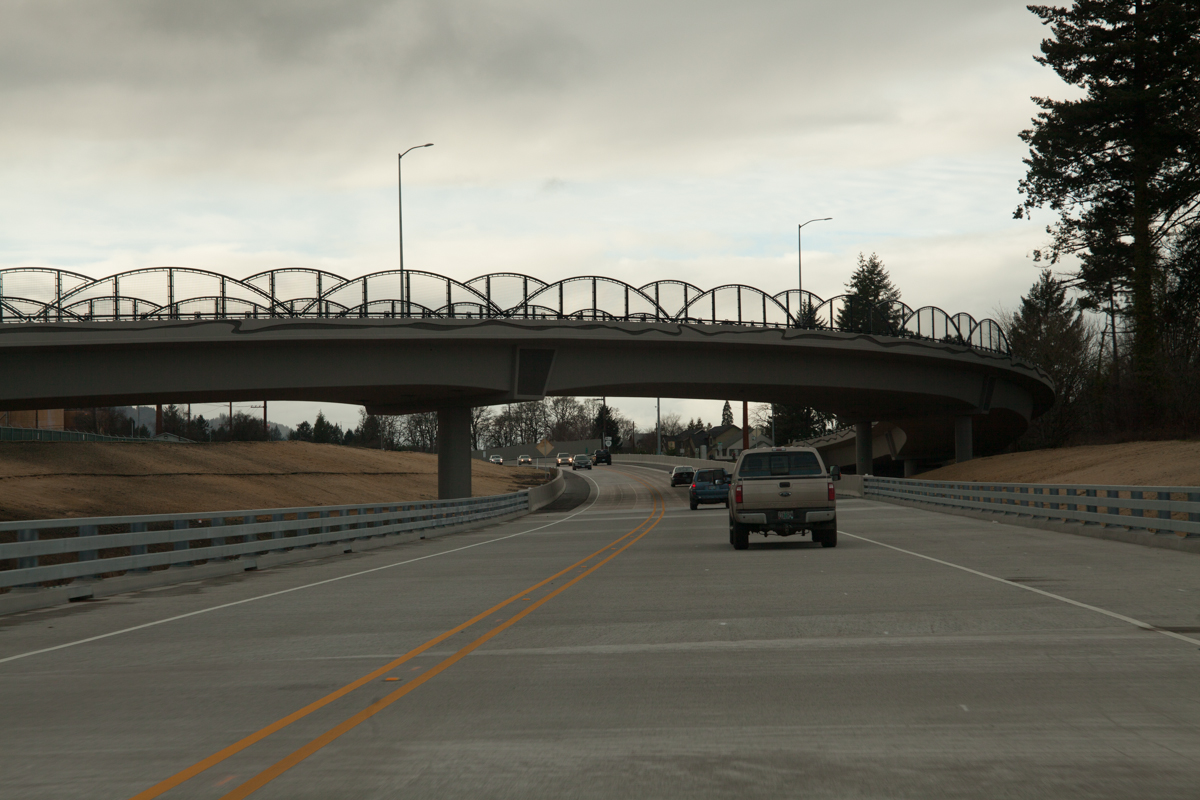
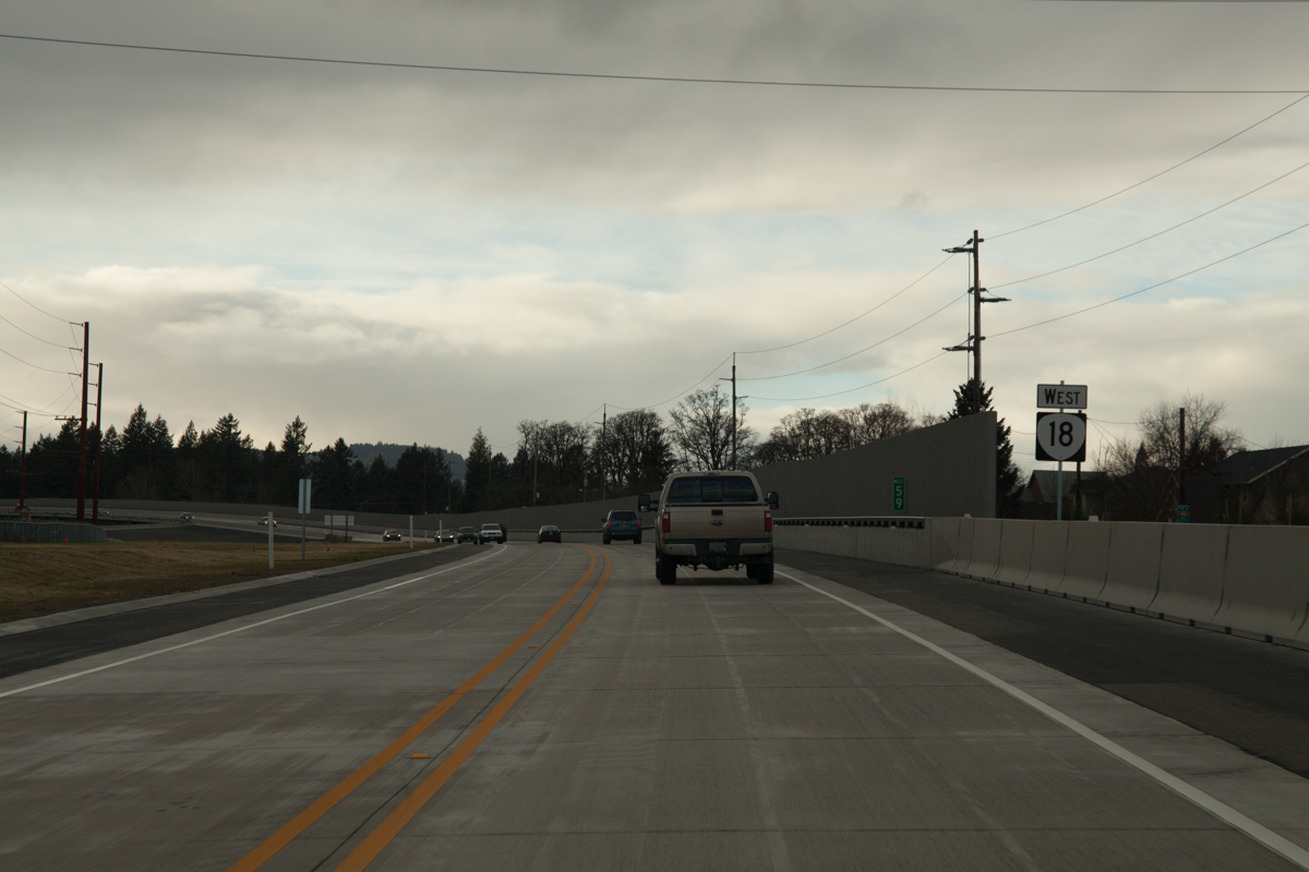
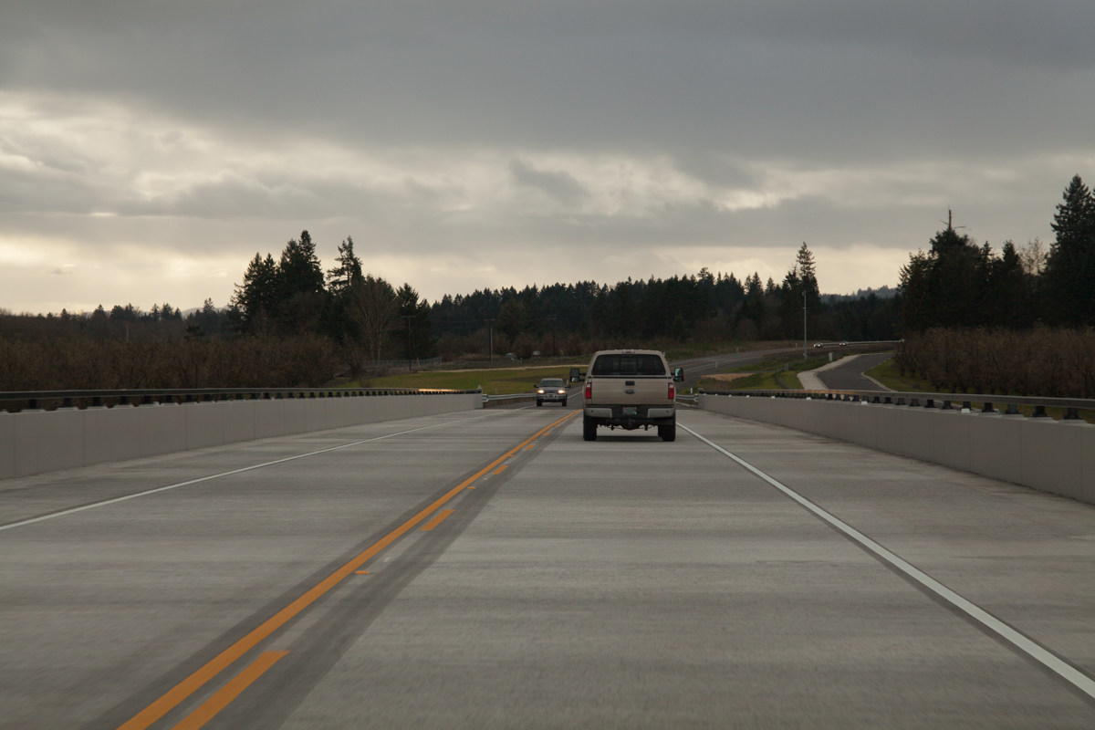
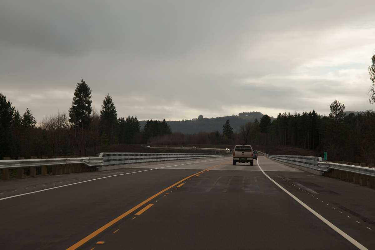
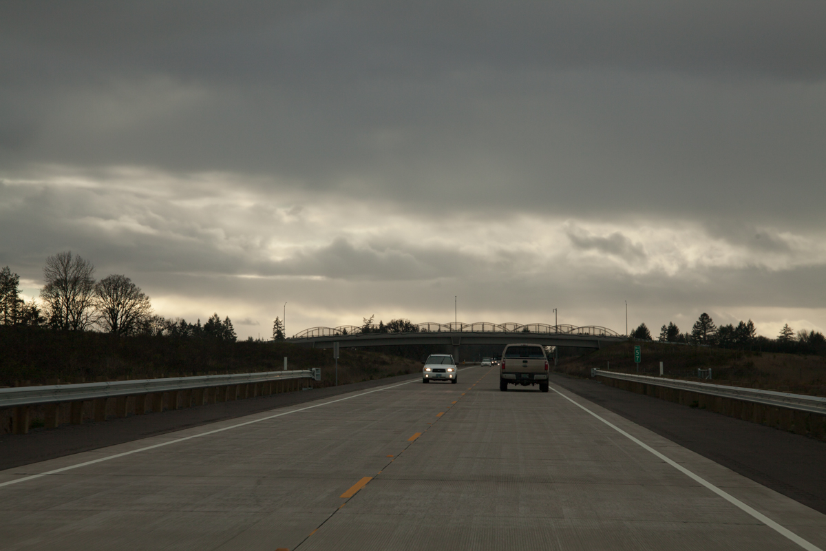
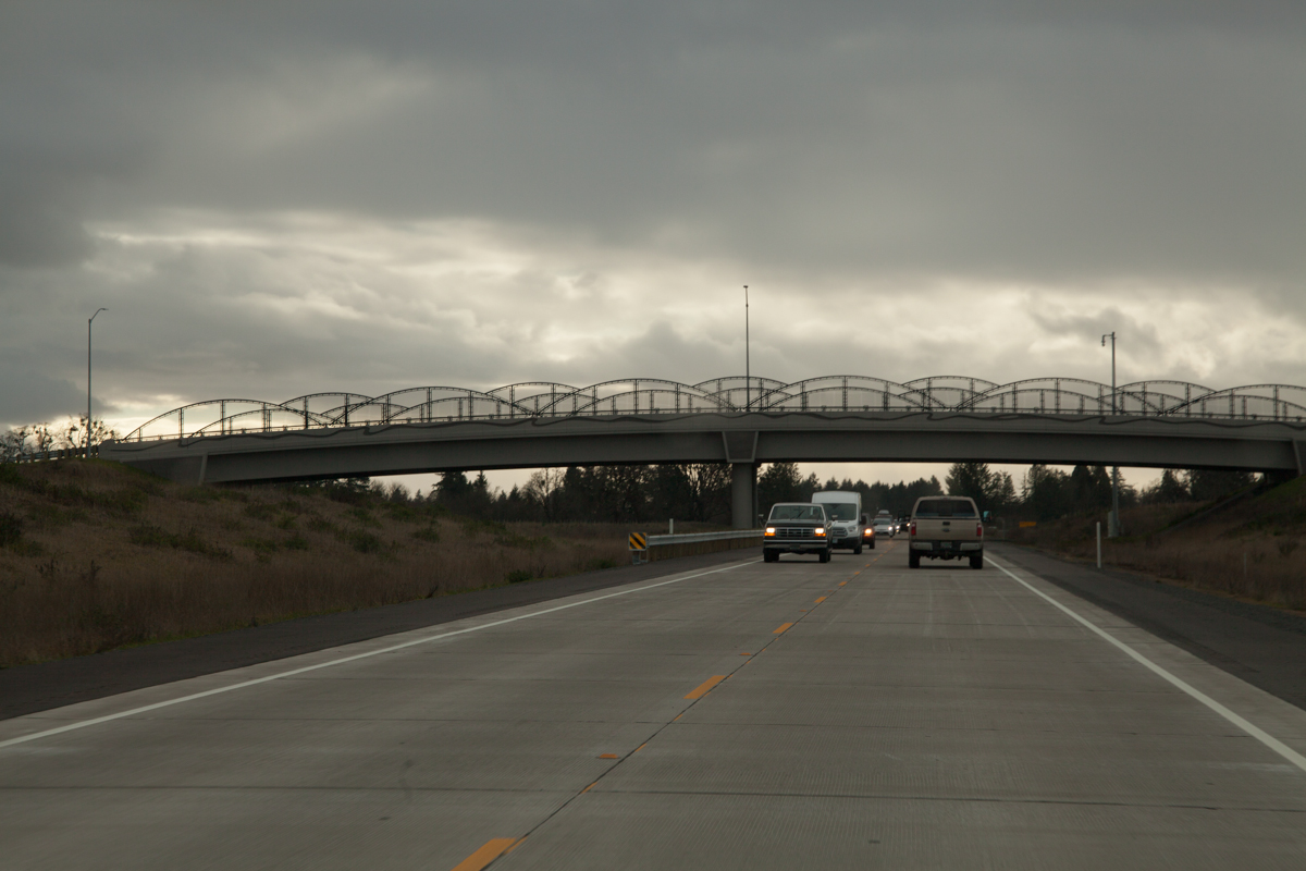
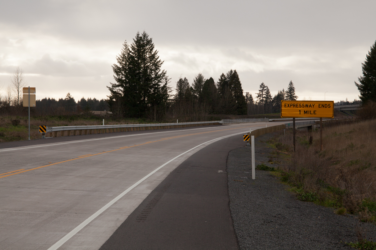
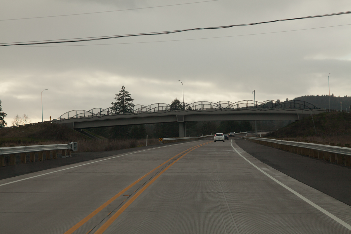
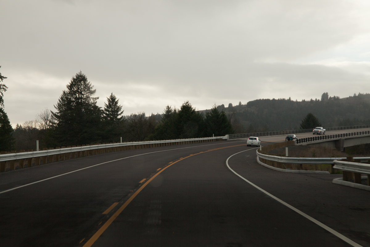
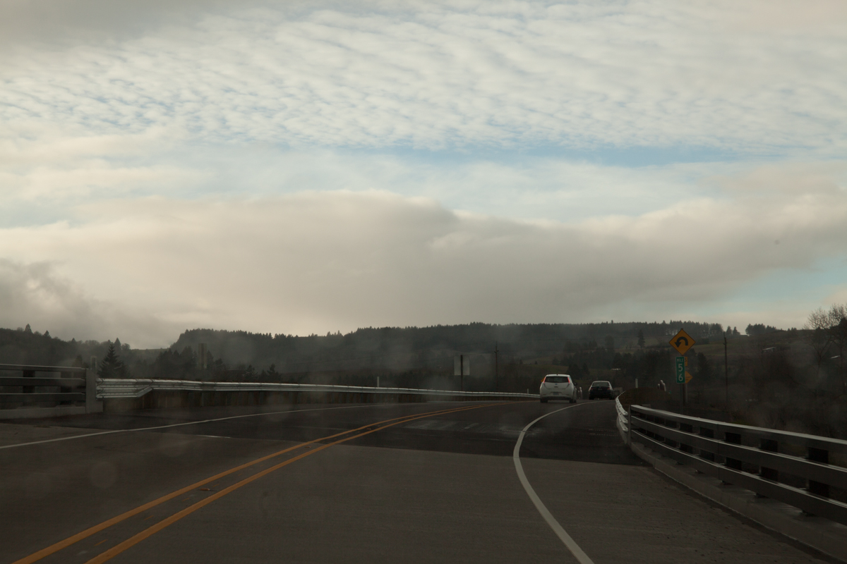
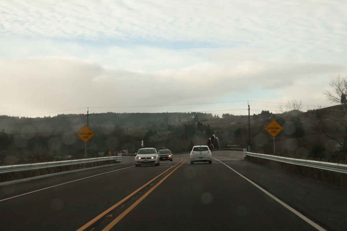
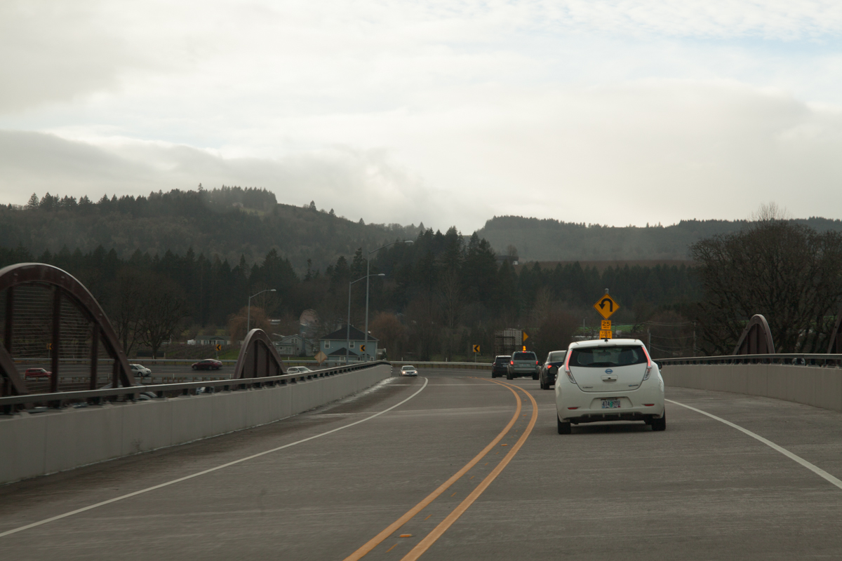
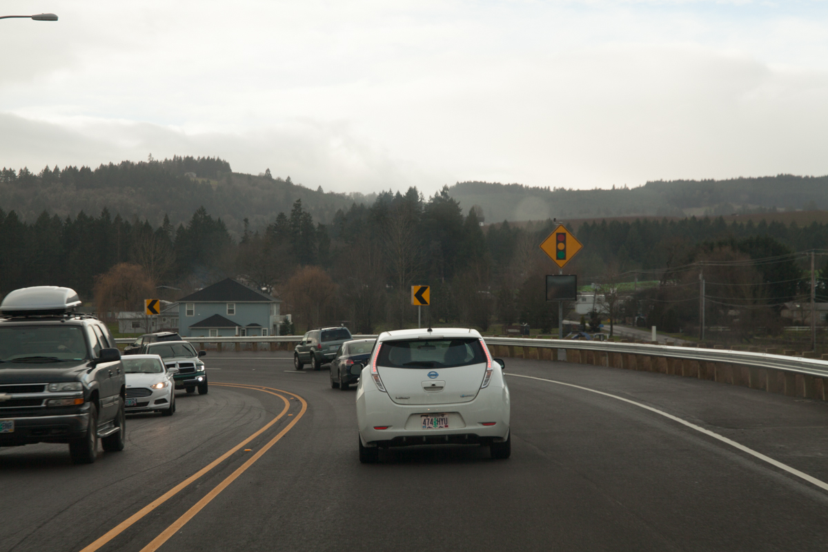
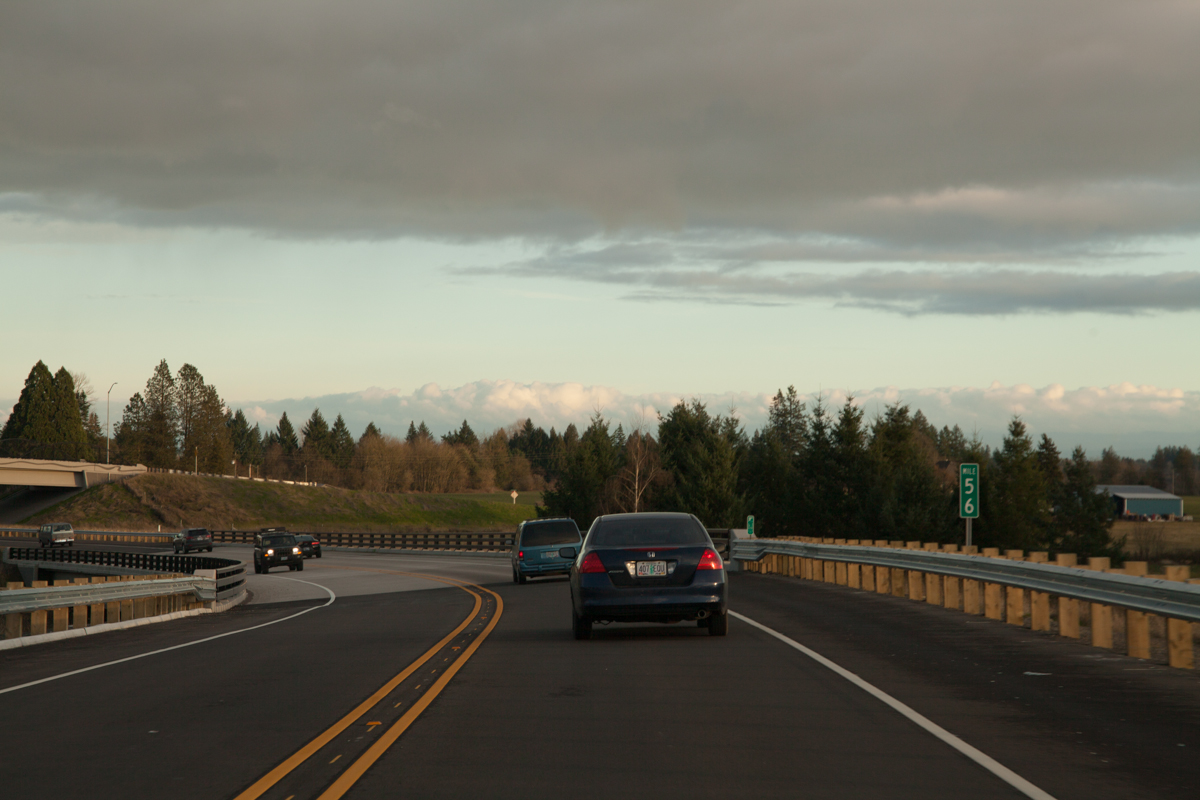
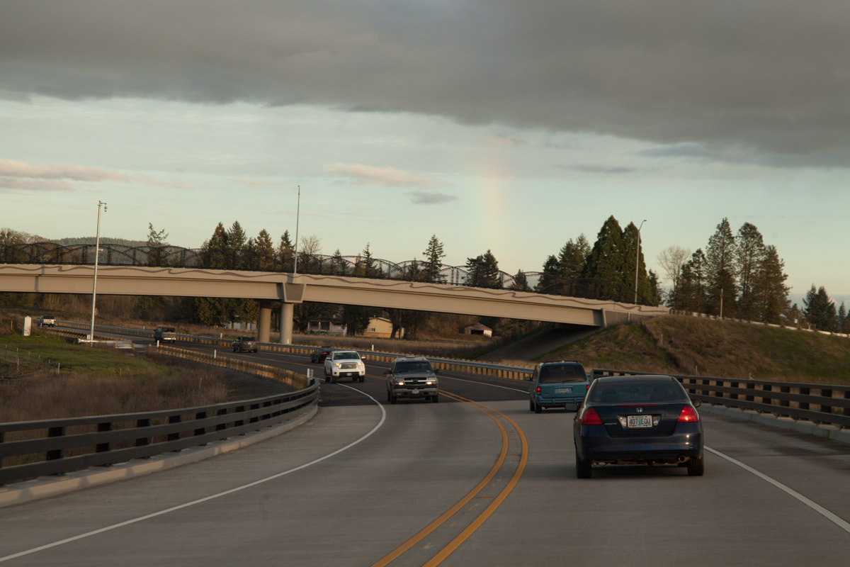
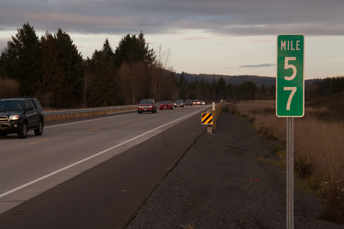
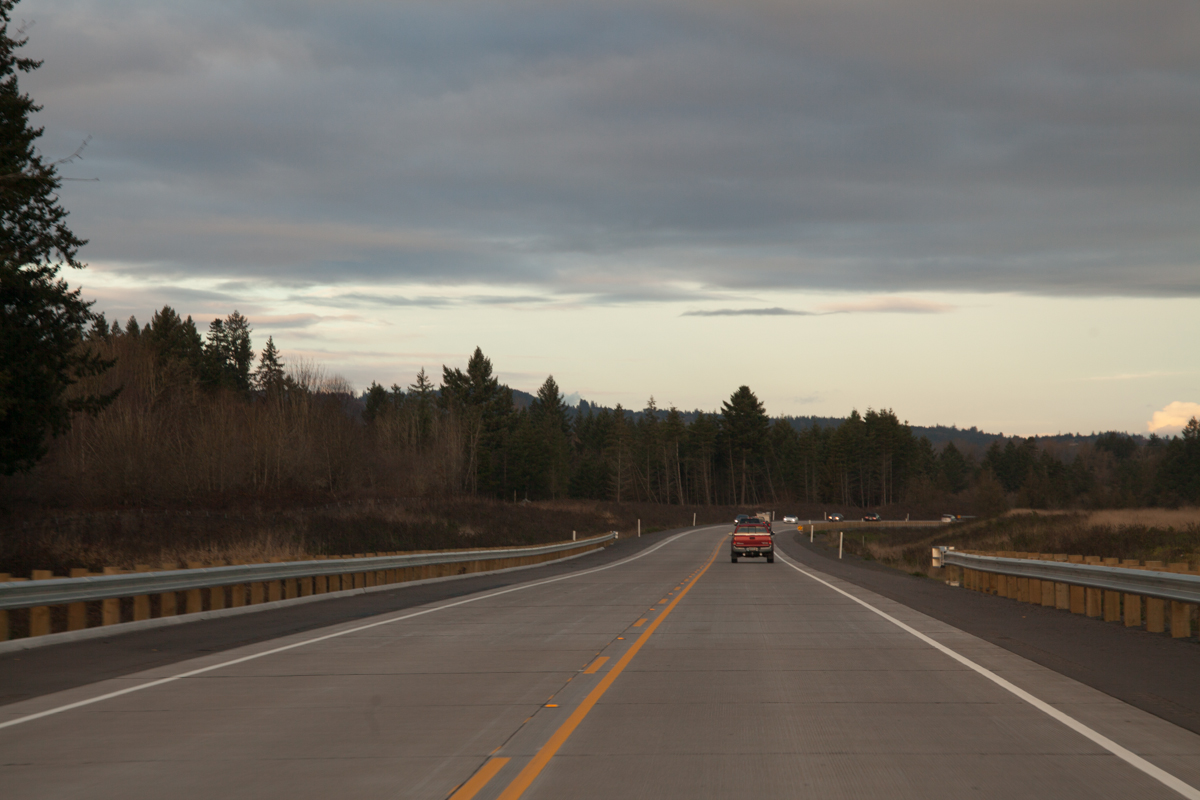
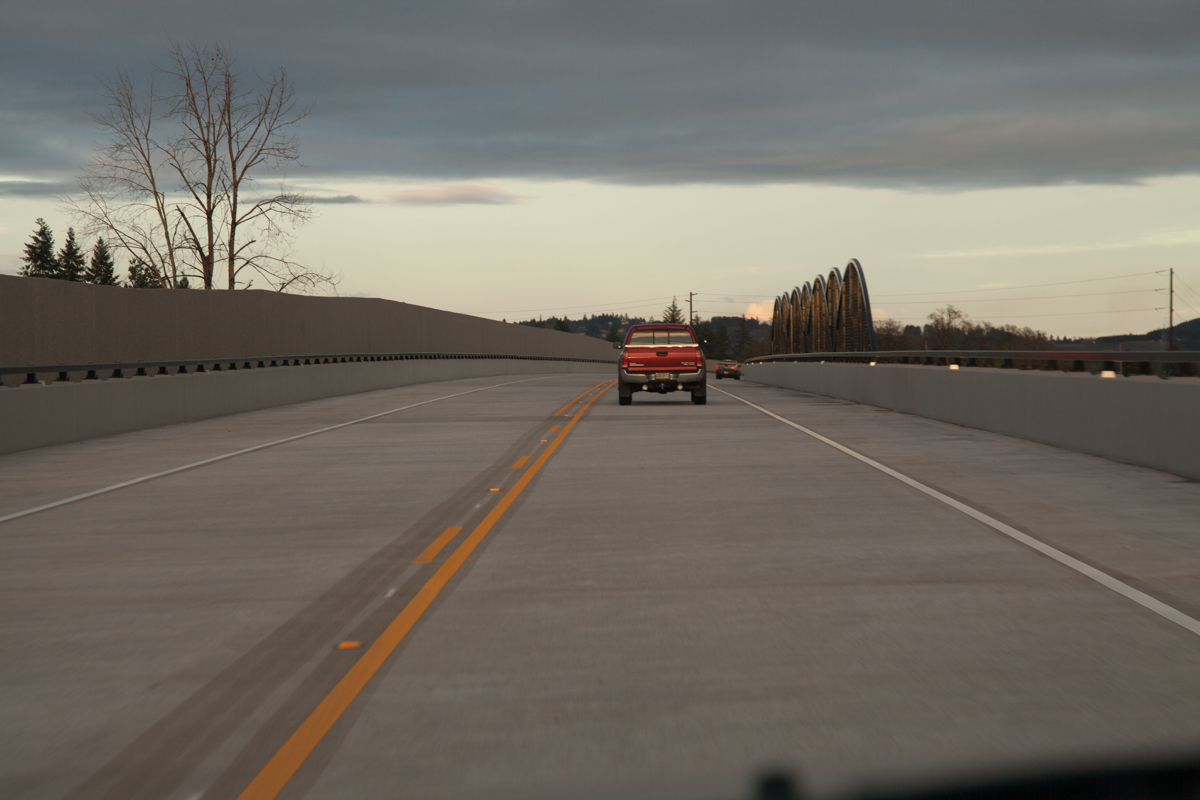
A reassurance shield for OR-18 near MP 59. This is the first ground-mounted reassurance marker for OR-18 I’ve seen — not even temporary markers are placed along the other streets, save for the overhead signs.Approaching the viaduct portion of the bypass. A landing for the future eastbound lanes can be seen on the left.This part is probably the least scenic part of the bypass, due to the SP Newsprint factory on the left and the soundwall on the right.The end of the viaduct. This was about as far north as I could walk along the bypass back in September for Play on the Bypass.MP 58. Self-explanatory. Compare to how it looked in September.The Chehalem Creek Bridge. Compare to how it looked in September.Just past the Chehalem Creek bridge, near where the East Dundee Interchange will be. According to the December 2014 project update newsletter, the lighter pavement is the Dundee portion of the contract fulfilled by Hamilton Construction of Springfield, Oregon. The darker half is the Newberg portion, paved by Wildish Standard Paving of Eugene. Compare to how it looked in September, including a close-up of the pavement change.Approaching MP 57 with the SE 8th St. overpass in the distance. Compare to how it looked in September.A close-up of the SE 8th St. overpass, which also passes over right-of-way set aside for the future eastbound lanes. Compare to how it looked in September.Approaching the bridge over an unnamed creek. An “Expressway Ends” sign is ahead at the curve. Compare to how it looked in September.A close-up of the “Expressway Ends” sign. Compare to how it looked in September from the opposite side of the highway.Nearing the SE Parks Dr. overpass, also known as “Fulquartz Loading Road”. A police turnout is on the left. As with the 8th St. overpass, right-of-way has been set aside for future widening to 4 lanes. Compare to how it looked in September.Curving towards the temporary end of the expressway over a couple of Hess Creek tributaries. When finished, the bypass will instead curve leftward towards the existing McMinnville Bypass portion of OR-18. Compare to how it looked in September.Traveling over the Hess Creek tributary bridges, which are considered “temporary” until Phase 3 is constructed. Compare to how it looked in September.MP 56 near a U-curve sign, which I haven’t seen too many of recently. The advised speed around the curve is 25. As you can see, it’s starting to rain. Such is life in Oregon. Compare to how it looked in September.Expressway Ends signs, as seen through an increasingly rainy windshield. The bridge passes over OR-99W and the Willamette & Pacific railroad tracks. Compare to how it looked in September.The bridge has had the finishing touches put on it, compared to a photo at this same spot in September. It’s real purdy now.Just before the curve, there’s a second U-curve sign, this time mounted to a “Your Speed” sign. I don’t remember if it started blinking once someone went over 25, but I imagine it does. Compare to how it looked in September.A traffic light ahead sign with a second one that shows “Stopped Vehicles Ahead” whenever the light is red.Signs on the mounted gantry in Dundee. The rightmost sign is the only indication that OR-18 is cosigned with 99W. See it here in September when it was empty.The end of the bypass. Two right turn lanes head south on OR-99W, merging shortly after the turn.
Dundee Scenes
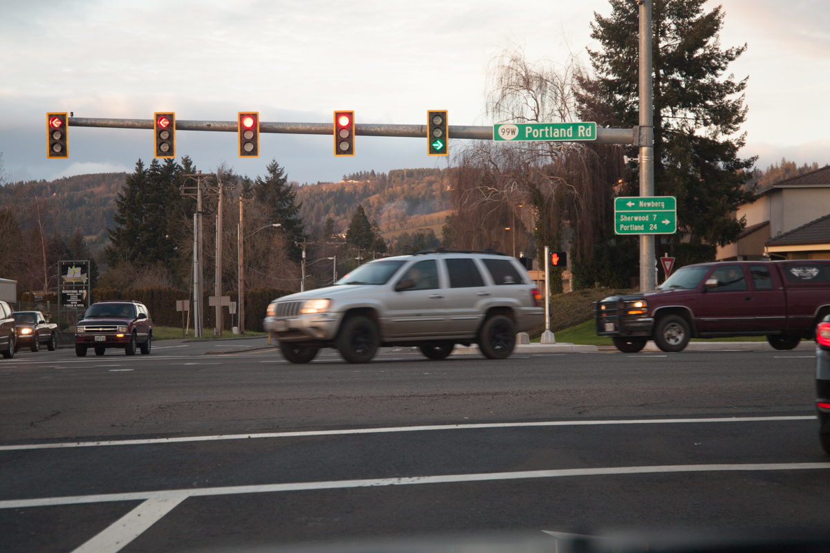
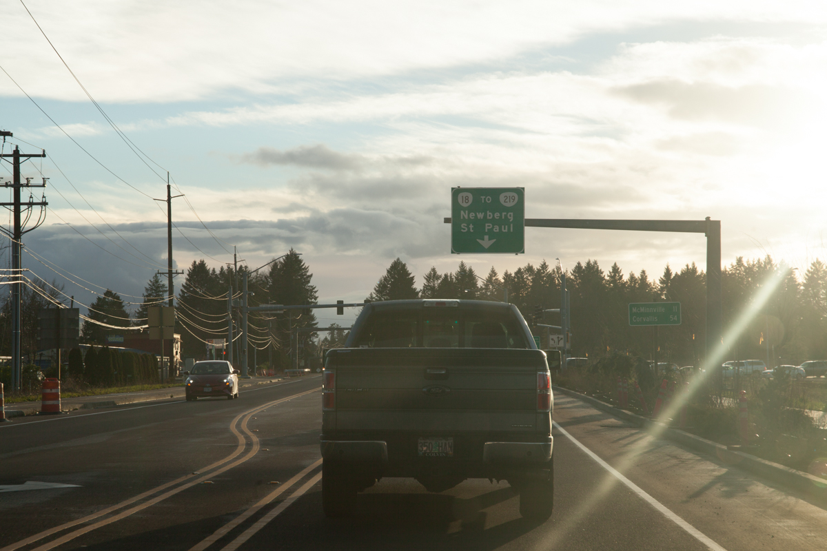
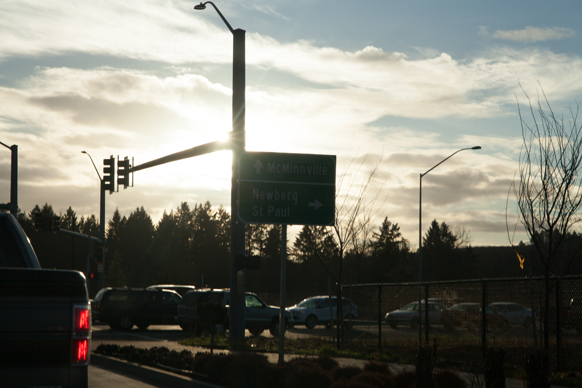
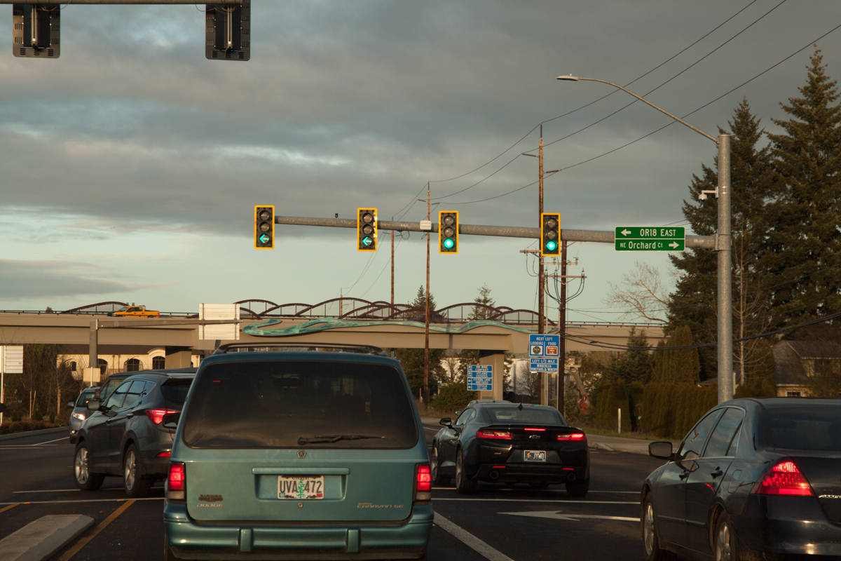
Southbound on OR-99W in downtown Dundee. In case the big bridge didn’t give it away, a “New Traffic Pattern Ahead” sign indicates the upcoming intersection with the bypass.The sun came out in force! Here you can (kinda) see an overhead sign for the routes and destinations for the bypass. St. Paul is south on OR-219, about 6 miles from the northern end of the bypass and 10 miles from here. The distance sign to McMinnville and Corvallis is also new, since it isn’t in this overhead photo from September.Directional signs for McMinnville and Newberg/St. Paul. I tried to block as much sun as I could to get this shot.A green light to head further south. Notice the street sign blade on the traffic light pointing to “OR18 EAST”, odd considering how rigid ODOT keeps to the shield-in-blade standard as of yet. Size is probably the factor here.After U-turning, we’re now heading northbound on 99W/hidden 18. This new VMS near Dundee tells drivers the bypass is open. This way also has a “New Traffic Pattern Ahead” sign.An overhead sign for OR-18 East to OR-219. I’m a bit surprised Portland isn’t listed as a control city in this direction, since a fair amount of travelers head between the Portland area and Grand Ronde/the Oregon coast. I bet ODOT believes people will put 2 and 2 together that the road to Newberg = the road to Portland.
Also, we get a cardinal direction for OR-18 in this direction, but not going the other direction. This is pretty standard for Oregon when one direction is considered more important than the other.
The Dundee sign gantry from the other direction.
Bypass Eastbound
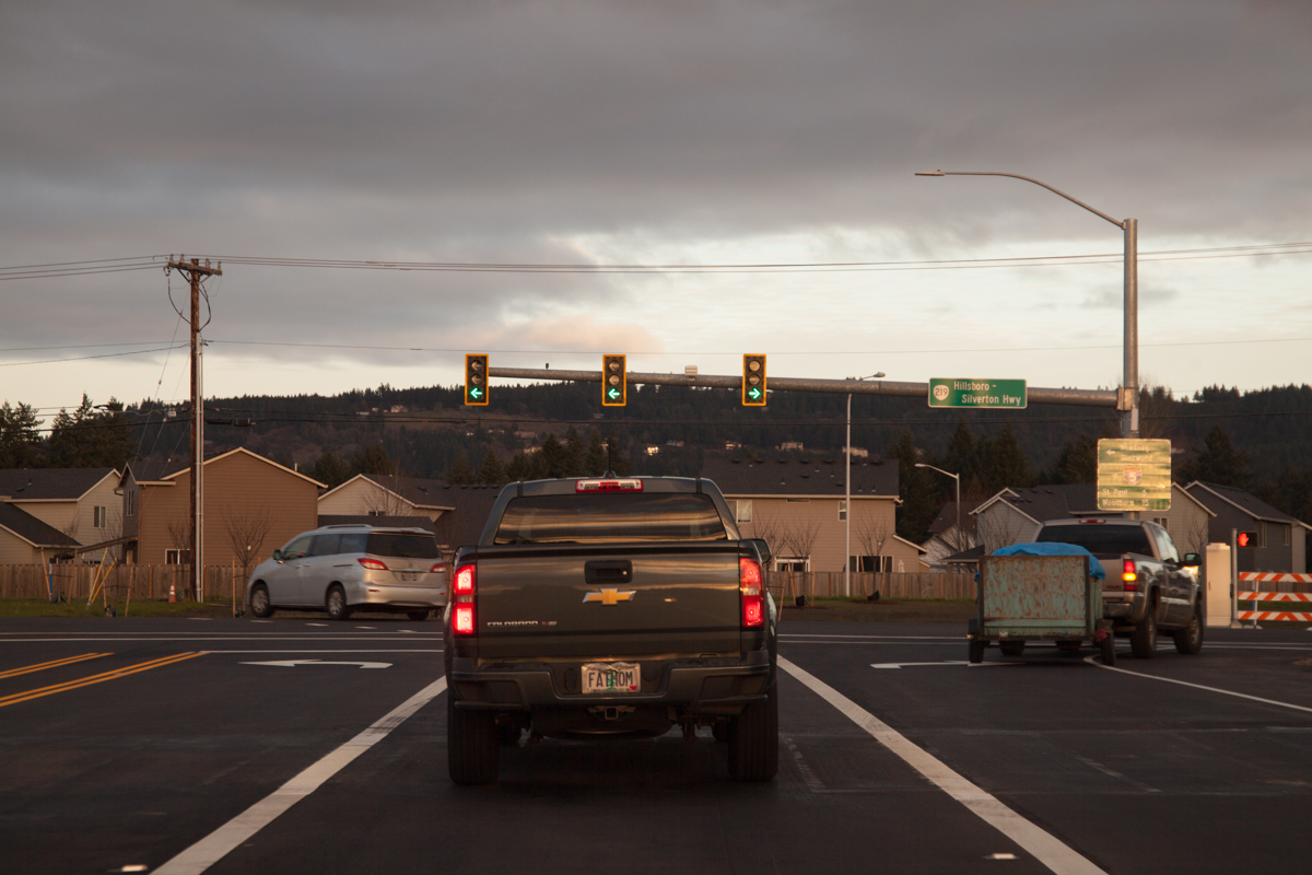
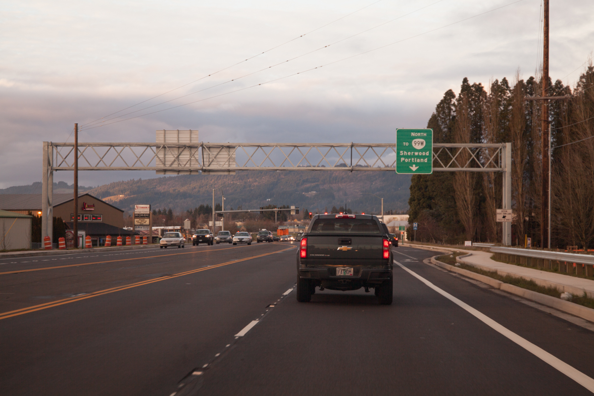
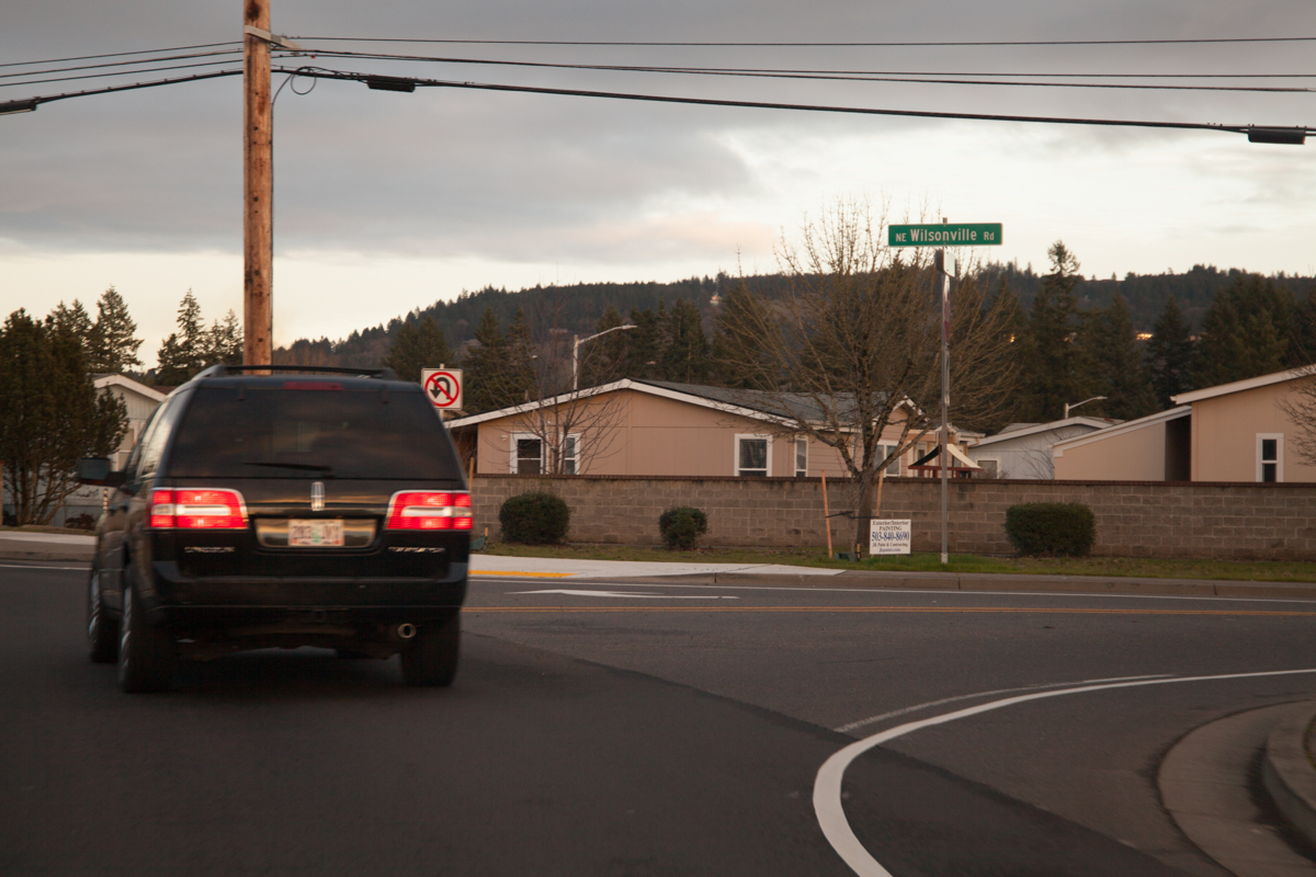
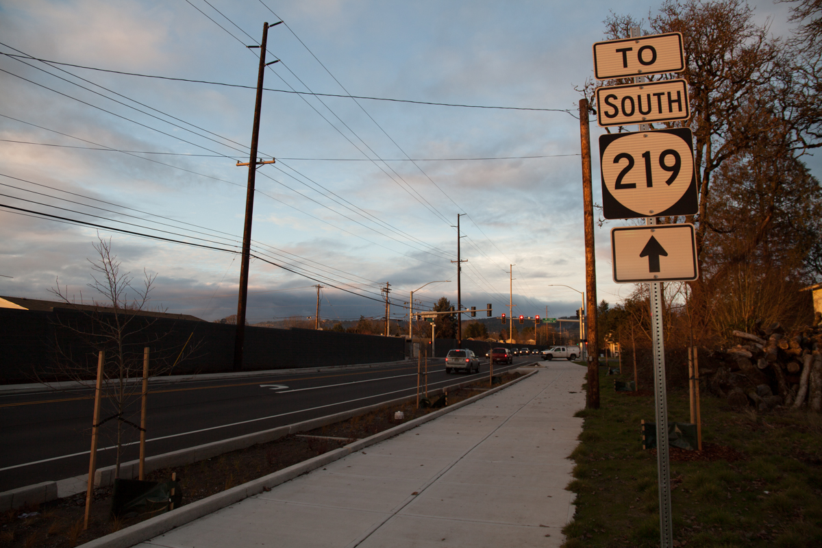
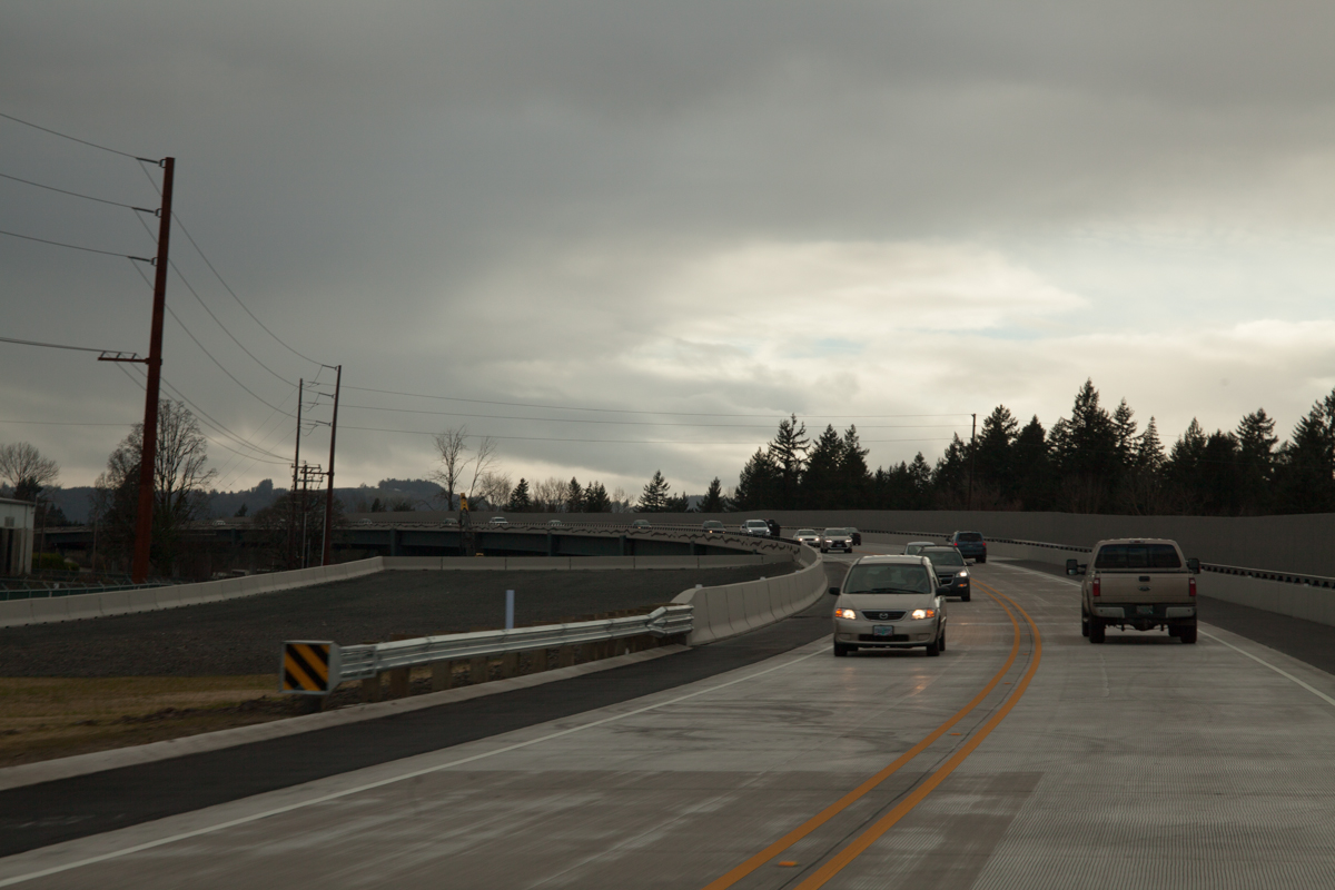
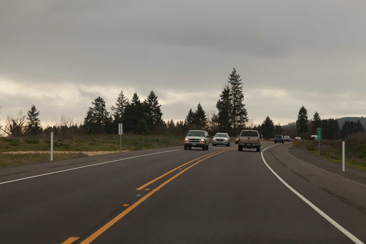
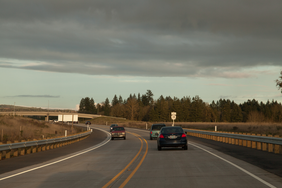
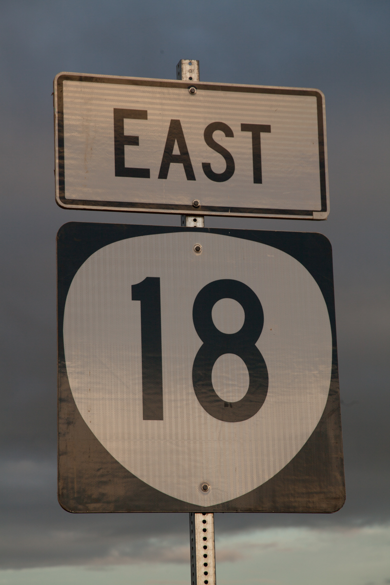
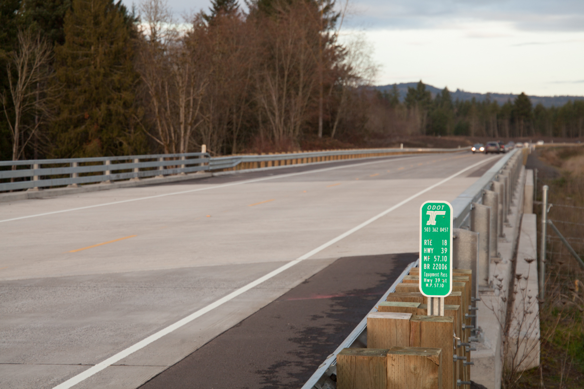
In line to take one of the two left turn lanes onto the bypass northbound/eastbound. Just like on OR-99W southbound, the sign blade points the way to “OR18 EAST”.Just like with the bypass southbound, the gantry sign states that it’s 4 miles to the next intersection.Two lanes become one around the curve.The bypass’ northbound “Speed 55” sign is located just before the bridge over the Hess Creek tributaries. Compare to how it looked in September.MP 56. Compare to how it looked in September.Approaching the SE Parks Dr. overpass (and the eventual merge from Phase 3). Compare to how it looked in September.The only eastbound reassurance shield is just past the Parks Dr. overpass. Both of the shields on the bypass are rather large. Compare to how it looked in September.A closer photo of the shield. It’s made of pressed wood.Looking ahead to the 8th Ave. overpass, where you can more easily see the reserved ROW. Compare to how it looked in September.A close up of MP 57. Compare to how it looked in September maybe 20 feet in front of this sign.A bridge inventory marker over a private farm road connecting two parcels bisected by the bypass. The text on the bottom reads “Equipment Pass Hwy 39 at M.P. 57.10” — a bit redundant if you ask me. This bridge appears on the Phase 1 map, but doesn’t have a label. (Either that, or the label on the map is placed and mileposted incorrectly.)A northeasterly-facing shot of the future location of the East Dundee interchange. Compare to how the same area looked in September.About to head over the viaduct. The parking area for Play on the Bypass is on the right, which again is the ROW for future expansion to 4 lanes. Compare to how it looked in September.The bypass looms ahead. Compare to how it looked in September.This was about as far as I could see eastbound at Play at the Bypass. The bridge is much more put together, though.A hasty shot at the end of the viaduct showing the wide right-of-way set aside for the future. Interesting that the eastbound approach is paved and has jersey barriers at this point. Seems a bit premature.Like its southern counterpart, the northern end also has an “Expressway Ends 1 Mile” sign. Points for consistency.MP 59 and the Wynooski Rd. overpass.The best shot I had of the companion “Expressway Ends” signs and the ROW for the future eastern lanes.A better shot showing the ROW beneath the overpass.Unlike heading westbound, the eastbound signage does not show OR-18 continuing along OR-219 and Springbrook Rd. These signs only show 219. Not even a “TO 99W” on the left sign. Come to think of it, I didn’t see 99W mentioned anywhere at that intersection in this direction.The temporary northern end of the bypass. The two left turn lanes take traffic towards 99W. The supplemental sign obscured by the sun shows directions and distances to Newberg and Sherwood to the left and I-5, St. Paul and Woodburn to the right. One can also reach I-5 going left, via Wilsonville Rd,, but it is not advertised as such because of how curvy that route is. (The original plans had Wilsonville Rd. actually intersecting here straight ahead. However, NIMBYism and safety concerns caused that connection to be moved to Springbrook Rd. instead to discourage use. Once Phase 2 of the bypass is completed, it will be moved again, this time south of the interchange.)Now on OR-219 north, we start to see references to 99W and Portland on signs. Sherwood is the next major suburb 99W northbound passes through after leaving Newberg.OR-219’s intersection with Springbrook Rd. Nothing really interesting going this direction; I included it for completeness.The aforementioned “intersection” with Wilsonville Rd. To discourage the road’s use as a pass-through from the Wilsonville area to the bypass, only right turns are allowed here. This situation makes for some interesting signage……like this shield assembly. Someone travelling from the bypass would think it’s odd to travel this direction to reach 219 south, considering they just could’ve turned south at the end of the bypass. It threw me off too at first, but this is more for directing people who come from Wilsonville Rd.A closer photo of the assembly. ODOT decided to use a 2-digit shield for some reason, a decision that brings back shades of the 1970s-specification shields. That “1” in the middle is probably the only reason this works.99W is in sight! We get another “To South OR-219” assembly, this time with a next-left arrow so traffic follows 99W southbound.Northbound traffic gets its own right turn arrow phase at this traffic light. The two signs in this photo are new.As darkness sets in, one final shot of the sign gantry north of Newberg, reassuring drivers that this takes you back to Portland. Compare to how it looked in September, including a milepost that was replaced with a newer version that’s two-sided.
Shots From Overpasses
SE Parks Drive
This is looking north/eastbound. The reassurance shield in this photo can be seen far in the distance around the curve, just left of center.Looking south/westbound as the bypass curves rightward towards Dundee. This also shows the right-of-way for the future eastbound lanes on the left as they disappear into a grove of trees.A different perspective of the same direction. This photo makes the ROW look even more like a tiny landing strip.The ODOT bridge inventory marker. Again with the redundant information.
SE 8th Avenue
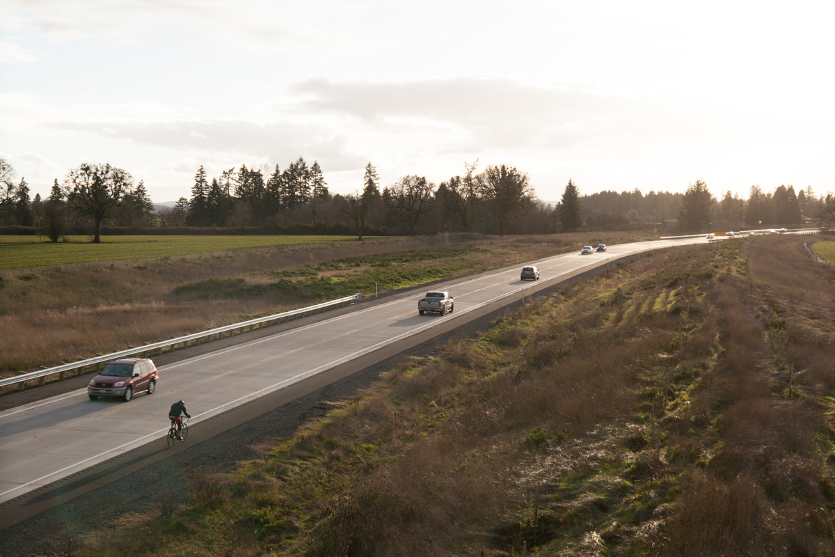
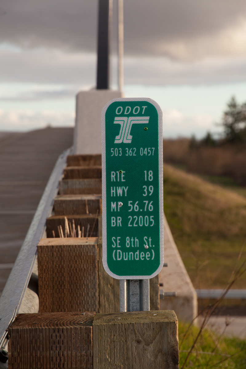
Looking south/westbound. Like almost all Oregon highways, the bypass is open to bikes.Same direction, different perspective. Compare to how it looked in September.Looking north/eastbound. Compare to how it looked in September.The ODOT bridge inventory marker. The “(Dundee)” looks a bit strange. However, I’m guessing this is to differentiate it from the 8th Street overpass on OR-18 in Dayton. Interesting coincidence.
Miscellaneous
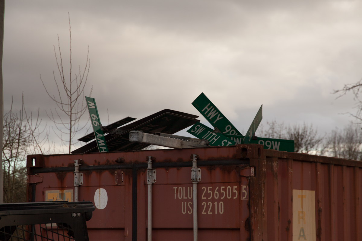
Just after travelling the bypass westbound, I turned towards Dundee and pulled off at the next right to orient myself and plan my next photos. I look to the right and see this:
SIGN GRAVEYARD!!
This was at a construction materials storage site just under the bridge in Dundee, at the corner of 99W and SE Parks Dr. The dumpster contains a bunch of old street signs for a few Dundee city streets and Yamhill County roads that intersected 99W around here. The larger guide sign on the left says “Crabtree Park 2”, which is run by the Chehalem Parks and Recreation District. That sign would’ve appeared at the corner of 99W and Niederberger Rd., which is more or less right across the street from this site.
There were a few other signs strewn about, but this was by far the coolest part.
Whew! Glad you followed along the entire journey. Thanks for popping in!


